Near Towanda in Bradford County, Pennsylvania — The American Northeast (Mid-Atlantic)
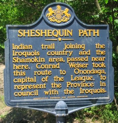
Sheshequin Path
Erected 1948 by Pennsylvania Historical and Museum Commission.
Topics and series. This historical marker is listed in these topic lists: Native Americans • Roads & Vehicles. In addition, it is included in the Pennsylvania Historical and Museum Commission series list.
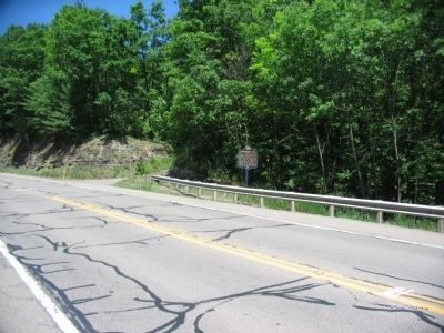
Location. 41° 48.312′ N, 76° 29.702′ W. Marker is near Towanda, Pennsylvania, in Bradford County. Marker is at the intersection of U.S. 220 and Hemlock Run Road, on the right when traveling north on U.S. 220. Touch for map. Marker is in this post office area: Towanda PA 18848, United States of America. Touch for directions.
Other nearby markers. At least 8 other markers are within 4 miles of this marker, measured as the crow flies. Oscalui (approx. 1.7 miles away); Armed Forces Memorial (approx. 2.7 miles away); Civil War Memorial (approx. 2.8 miles away); William W. Hawes House (approx. 3 miles away); James H. Hawes House (approx. 3.3 miles away); Maxwell-Bennett House (approx. 3.3 miles away); David Wilmot (approx. 3.3 miles away); Dr. Samuel Huston House (approx. 3.4 miles away). Touch for a list and map of all markers in Towanda.
Related markers. Click here for a list of markers that are related to this marker. To better understand the relationship, study the markers shown.
Also see . . . Sheshequin Path. Wikipedia entry. (Submitted on July 17, 2010, by Craig Swain of Leesburg, Virginia.)
Credits. This page was last revised on June 16, 2016. It was originally submitted on July 17, 2010, by Craig Swain of Leesburg, Virginia. This page has been viewed 919 times since then and 19 times this year. Photos: 1, 2. submitted on July 17, 2010, by Craig Swain of Leesburg, Virginia.

