Near Lewiston in Montmorency County, Michigan — The American Midwest (Great Lakes)
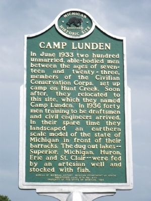
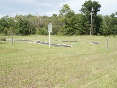
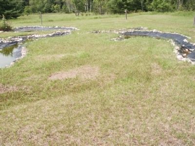
Camp Lunden
Erected 1994 by Bureau of Michigan History, Michigan Department of State. (Marker Number L647.)
Topics and series. This historical marker is listed in these topic lists: Animals • Charity & Public Work • Parks & Recreational Areas • Waterways & Vessels. In addition, it is included in the Civilian Conservation Corps (CCC), and the Michigan Historical Commission series lists. A significant historical month for this entry is June 1933.
Location. 44° 53.037′ N, 84° 10.731′ W. Marker is near Lewiston, Michigan, in Montmorency County. Marker is at the intersection of County Route 612 and Fish Lab Road, on the left when traveling east on County Route 612. This marker can be found approx. 6.25 miles east of Lewiston. Touch for map. Marker is at or near this postal address: 11018 County Road 612, Lewiston MI 49756, United States of America. Touch for directions.
Other nearby markers. At least 3 other markers are within 9 miles of this marker, measured as the crow flies. Congregational United Church of Christ (approx. 6.2 miles away); Angusdale Stock Farm (approx. 8.4 miles away); Big Rock (approx. 8.9 miles away).
Also see . . . Google Maps. Check out the aerial view on Google Maps. (Submitted on September 16, 2019, by Joel Seewald of Madison Heights, Michigan.)
Credits. This page was last revised on June 17, 2022. It was originally submitted on July 20, 2010, by Joel Seewald of Madison Heights, Michigan. This page has been viewed 1,232 times since then and 59 times this year. Photos: 1, 2, 3. submitted on July 20, 2010, by Joel Seewald of Madison Heights, Michigan. • Syd Whittle was the editor who published this page.


