Brownsboro in Madison County, Alabama — The American South (East South Central)
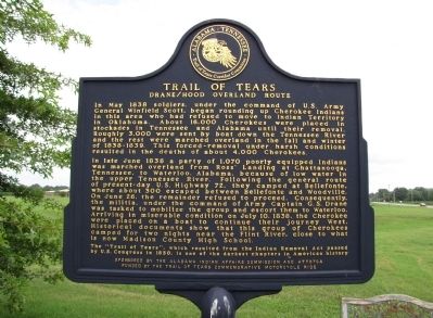
Trail of Tears
Drane/Hood Overland Route
In late June of 1838 a party of 1,070 poorly equipped Indians was marched overland from Ross' Landing at Chattanooga, Tennessee, to Waterloo, Alabama, because of low water in the upper Tennessee River. Following the general route of present day U.S. Highway 72, they camped at Bellefonte, where about 300 escaped between Bellefonte and Woodville. On June 26, the remainder refused to proceed. Consequently,the militia, under the command of Army Captain G.S. Drane was tasked to mobilize the group and escort them to Waterloo. Arriving in miserable condition on July 10, 1838, the Cherokee were placed on a boat to continue their journey West. Historical documents show that this group of Cherokees camped for two nights near the Flint River, close to what is now Madison County High School.
The "Trail of Tears" which resulted from the Indian Removal Act passed by U.S. Congress in 1830, is one of the darkest chapters in American history.
Erected by The Alabama Indian Affairs Commission and ATTOTCA - Funded by the Trail of Tears Commemorative Motorcycle Ride.
Topics and series. This historical marker is listed in these topic lists: Government & Politics • Military • Native Americans • Notable Events. In addition, it is included in the Trail of Tears series list. A significant historical month for this entry is May 1838.
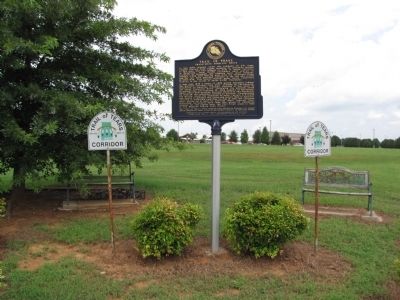
Location. 34° 44.141′ N, 86° 25.845′ W. Marker is in Brownsboro, Alabama, in Madison County. Marker is at the intersection of Lee Highway/John T. Reid Parkway (U.S. 72 at milepost 109) and Brock Road, on the right when traveling west on Lee Highway/John T. Reid Parkway. Marker is located on the grounds of the Madison County High School. Touch for map. Marker is in this post office area: Brownsboro AL 35741, United States of America. Touch for directions.
Other nearby markers. At least 8 other markers are within 6 miles of this marker, measured as the crow flies. Flint River Primitive Baptist Church (approx. 2˝ miles away); Central High School/Central Junior High School (approx. 2˝ miles away); a different marker also named Flint River Primitive Baptist Church (approx. 2˝ miles away); Shiloh United Methodist Church (approx. 3˝ miles away); Town of Gurley (approx. 4 miles away); "Wildwood" (approx. 4.9 miles away); Monte Sano Railway (approx. 5 miles away); Lowell M. Anderson (approx. 5˝ miles away).
Credits. This page was last revised on June 16, 2016. It was originally submitted on July 20, 2010, by Lee Hattabaugh of Capshaw, Alabama. This page has been viewed 1,934 times since then and 55 times this year. Photos: 1, 2, 3. submitted on July 20, 2010, by Lee Hattabaugh of Capshaw, Alabama. • Bill Pfingsten was the editor who published this page.


