Stone Mountain in DeKalb County, Georgia — The American South (South Atlantic)
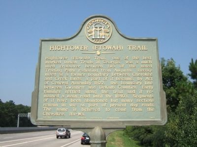
Hightower (Etowah) Trail
Erected 1956 by Georgia Historical Commission. (Marker Number 044-54B.)
Topics and series. This historical marker is listed in these topic lists: Native Americans • Roads & Vehicles • Settlements & Settlers. In addition, it is included in the Georgia Historical Society series list. A significant historical year for this entry is 1822.
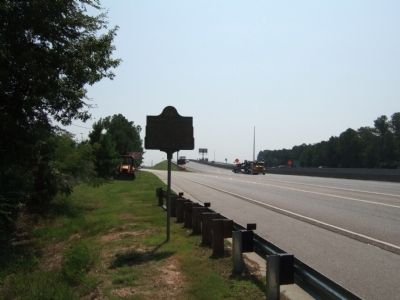
Location. 33° 49.39′ N, 84° 7.541′ W. Marker is in Stone Mountain, Georgia, in DeKalb County. Marker is on Stone Mountain Freeway (U.S. 78) 0.2 miles west of West Park Place Boulevard, on the right when traveling west. This marker is located on the west bound side of Highway 78 now and is not visible from the divided highway east bound side. Touch for map. Marker is in this post office area: Stone Mountain GA 30087, United States of America. Touch for directions.
Other nearby markers. At least 8 other markers are within 2 miles of this marker, measured as the crow flies. Allen House (approx. 1.2 miles away); Powell Academy (approx. 1.2 miles away); Powell Academy Schoolhouse (approx. 1.2 miles away); Davis House (approx. 1.2 miles away); "Medicine House" (approx. 1.2 miles away); DR. Chapmon Powell's Cabin (approx. 1.2 miles away); Thornton House (approx. 1.2 miles away); So, What Happened Here? (approx. 1.2 miles away). Touch for a list and map of all markers in Stone Mountain.
Related markers. Click here for a list of markers that are related to this marker. To better understand the relationship, study each marker in the order shown.
Credits. This page was last revised on June 16, 2016. It was originally submitted on August 4, 2008, by Felch Dumas of Decatur, Georgia. This page has been viewed 1,805 times since then and 26 times this year. Last updated on July 22, 2010, by David Seibert of Sandy Springs, Georgia. Photos: 1, 2. submitted on August 4, 2008, by Felch Dumas of Decatur, Georgia. • Craig Swain was the editor who published this page.

