North Huntingdon Township in Irwin in Westmoreland County, Pennsylvania — The American Northeast (Mid-Atlantic)
Braddock's Military Road 1755
"Three Springs" Camp
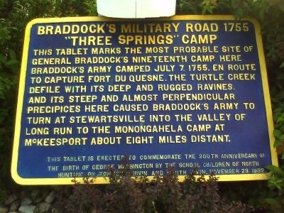
Photographed by William Richard Harrison, July 18, 2010
1. Braddock's Military Road 1755 "Three Springs" Camp Marker
Erected 1932.
Topics and series. This historical marker is listed in these topic lists: Colonial Era • Military • Roads & Vehicles • War, French and Indian. In addition, it is included in the Braddock’s Road and Maj. Gen. Edward Braddock series list. A significant historical date for this entry is July 7, 1779.
Location. 40° 19.67′ N, 79° 44.255′ W. Marker is in Irwin, Pennsylvania, in Westmoreland County. It is in North Huntingdon Township. It is at the intersection of Clay Pike and Robbins Station Road on Clay Pike. Marker is low to the ground between shrubs under the sign for the First National Bank at the corner of Clay Pike and Robbins Station Road. Touch for map. Marker is at or near this postal address:
this page online

Regionally, this marker is in the Laurel Highlands and in Greater Pittsburgh. It is also in the American Northeast, in the Mid-Atlantic, in Appalachia, and specifically in Northern Appalachia. Globally, it is in North America, the Western Hemisphere, the Western World, and the Anglosphere. Historically, it finds itself in what was once the Viceroyalty of New France, the Haudenosaunee (Iroquois) Confederacy, and one of the original Thirteen Colonies.
Other nearby markers. At least 8 other markers are within walking distance of this marker: A Lasting Tribute (about 500 feet away, measured in a direct line); Larimer's Mansion Farm (approx. 0.2 miles away); Long Run Church (approx. ¼ mile away); Long Run Cemetery Veterans Memorial (approx. ¼ mile away); North Huntingdon Township Veterans Memorial (approx. 0.4 miles away); The Marchand House (approx. 0.6 miles away); "The McIntyre House" (approx. 0.6 miles away); The Fullerton House (approx. 0.6 miles away). Touch for a list and map of all markers in Irwin.
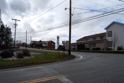
Photographed by Mike Wintermantel, January 4, 2015
2. Braddock's Military Road 1755 "Three Springs" Camp Marker
Credits. This page was last revised on April 14, 2025. It was originally submitted on July 20, 2010, by William Richard Harrison of Pittsburgh, Pennsylvania. This page has been viewed 4,714 times since then and 156 times this year. Last updated on July 25, 2010, by William Richard Harrison of Pittsburgh, Pennsylvania. Photos: 1. submitted on July 20, 2010, by William Richard Harrison of Pittsburgh, Pennsylvania. 2. submitted on January 4, 2015, by Mike Wintermantel of Pittsburgh, Pennsylvania. • Bill Pfingsten was the editor who published this page.
