Near Preston in Caroline County, Maryland — The American Northeast (Mid-Atlantic)
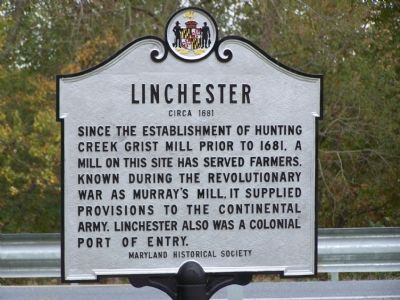
Linchester
Circa 1681
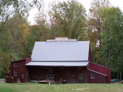
Since the establishment of Hunting Creek Grist Mill prior to 1681, a mill on this site has served farmers. Known during the Revolutionary War as Murray’s Mill, it supplied provisions to the Continental Army. Linchester also was a Colonial Port of Entry.
Erected by Maryland Historical Society.
Topics. This historical marker is listed in these topic lists: Agriculture • Colonial Era • Industry & Commerce • War, US Revolutionary. A significant historical year for this entry is 1681.
Location. 38° 42.085′ N, 75° 53.821′ W. Marker is near Preston, Maryland, in Caroline County. Marker is at the intersection of Maryland Route 331 and Linchester Road, on the right when traveling south on State Route 331. Touch for map. Marker is in this post office area: Preston MD 21655, United States of America. Touch for directions.
Other nearby markers. At least 8 other markers are within 2 miles of this marker, measured as the crow flies. The Underground Railroad (within shouting distance of this marker); Linchester Mill (within shouting distance of this marker); a different marker also named Linchester Mill (about 300 feet away, measured in a direct line); Leverton House (approx. 0.4 miles away); Freedom (approx. 0.6 miles away); Preston (approx. 0.9 miles away); Site of Frazier’s Chapel (approx. one mile away); Mt. Pleasant Cemetery (approx. 2 miles away). Touch for a list and map of all markers in Preston.
Also see . . .
1. Linchester Mill. Wikipedia entry (Submitted on February 24, 2024, by Larry Gertner of New York, New York.)
2. Mill Folklore: "History or Hearsay". Included in the discussion about the invention of the grain elevator is a picture of the last Linchester Mill operator, Captain Frank Samuel Langrell, in 1974. (Submitted on April 20, 2009.)
Credits. This page was last revised on February 24, 2024. It was originally submitted on November 6, 2007, by Bill Pfingsten of Bel Air, Maryland. This page has been viewed 2,266 times since then and 23 times this year. Photos: 1, 2. submitted on November 6, 2007, by Bill Pfingsten of Bel Air, Maryland.

