Tampa in Hillsborough County, Florida — The American South (South Atlantic)
Timuquan Indian Mound
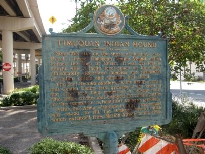
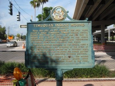
Near this site on the shore of the bay, once stood a large Timuquan Temple Mound dating before the time of Christ. It was 50 feet in height with a large level space on top where elaborately decorated temples and residences of Indian chiefs and shamans had stood.
The Fort Brooke soldiers, in the 1840's, used a tall Gumbo Limbo tree growing at the crest of the city-block long mound as a lookout post. The ladies of the post enjoyed ice cream parties at the summit in a beautiful Chinese pavilion.
After the Army withdrew in 1882, the mound was razed to fill the Jackson Street ditch which extended from Marion Street to the river.
Erected by
The Timuquanian Society, Inc. with the cooperation of The Tampa Historical Society.
Topics. This historical marker is listed in these topic lists: Anthropology & Archaeology • Forts and Castles • Native Americans • Settlements & Settlers. A significant historical year for this entry is 1882.
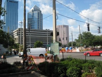
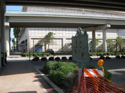
Location. Marker has been permanently removed. It was located near 27° 56.613′ N, 82° 27.377′ W. Marker was in Tampa, Florida, in Hillsborough County. Marker was at the intersection of South Franklin Street and East Brorein Street, on the left when traveling north on South Franklin Street. Traffic on Florida Avenue is one-way, northbound. The marker is located under an elevated section of the Leroy Selmon Crosstown Expressway, adjacent to a walkway under the structure.
As of summer, 2010, the area around the marker was undergoing roadwork for an extension of the TECO Line Streetcar System. Touch for map. Marker was in this post office area: Tampa FL 33602, United States of America.
We have been informed that this sign or monument is no longer there and will not be replaced. This page is an archival view of what was.
Other nearby markers. At least 8 other markers are within walking distance of this location. Site of Fort Brooke (about 500 feet away, measured in a direct line); Officers Quarters Fort Brooke (about 600 feet away); Site of Mirabella Fish Company (about 700 feet away); Fort Brooke Cemetery (approx. 0.2 miles away); Old Fort Brooke Municipal Parking Structure (approx. 0.2 miles away); Tampa Salutes MacDill AFB (approx. 0.2 miles away); In the Beginning... (approx. 0.2 miles away); Tampa Goes to War (approx. 0.2 miles away). Touch for a list and map of all markers in Tampa.
More about this marker. The marker is capped with the seal of the Tampa Historical Society.
This marker will be replaced in 2024 with an updated marker.
Regarding Timuquan Indian Mound. The tribal nation of the Timuquans (also spelled "Timucuan" or simply, "Timucua") that once thrived in the Tampa Bay area at one time numbered as many as 200,000 people across Florida and Georgia. They had been long extinct by the time of the American settlers and Fort Brooke. Disease and war, brought over by the Spanish conquistadors, reduced the tribe to only 1000 or so by the year 1700. After that, war with English colonists and other native tribes quickly brought the Timuquans' extinction.
Additional keywords. Timucua, Timucuan
Credits. This page was last revised on October 19, 2023. It was originally submitted on August 1, 2010, by Glenn Sheffield of Tampa, Florida. This page has been viewed 1,999 times since then and 33 times this year. Photos: 1, 2, 3, 4. submitted on August 1, 2010, by Glenn Sheffield of Tampa, Florida. • Craig Swain was the editor who published this page.


