Wharton Township near Farmington in Fayette County, Pennsylvania — The American Northeast (Mid-Atlantic)
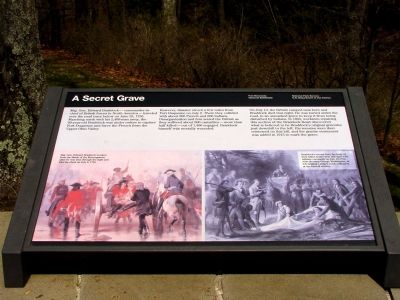
A Secret Grave
Fort Necessity National Battlefield
— National Park Service, U.S. Department of the Interior —
Maj. Gen. Edward Braddock—commander-in-chief of British forces in North America—traveled over the road trace below on June 25, 1755. Marching north with his 2,400-man army, the 60-year-old Braddock was under orders to capture Fort Duquesne and force the French from the Upper Ohio Valley.
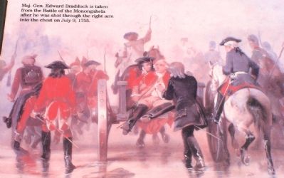
However, disaster struck a few miles from Fort Duquesne on July 9. There they collided with about 200 French and 600 Indians. Disorganization and fear seized the British as they suffered about 900 casualties—more than half killed—out of 1,400 engaged. Braddock himself was mortally wounded.
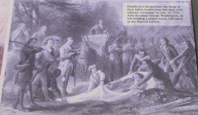
On July 13, the British camped near here and Braddock died that night. He was buried under the road, in an unmarked grave to keep it from being disturbed by Indians. In 1804, workmen repairing this section of the Braddock Road discovered what is believed to be Braddock's original gravesite just downhill to the left. His remains were then reinterred on this hill, and the granite monument was added in 1913 to mark the grave.
Erected by National Park Service, U.S. Department of the Interior.
Topics and series. This historical marker is listed in these topic lists: Colonial Era • War, French and Indian. In addition, it is included in the Braddock’s Road and Maj. Gen. Edward Braddock series list. A significant historical month for this entry is June 1755.
Location. 39° 49.947′ N, 79° 36.056′ W. Marker is near Farmington, Pennsylvania, in Fayette County. It is in Wharton Township. Marker can be reached from National Pike (U.S. 40) 1.2 miles east of Fayette Springs Road. Touch for map. Marker is in this post office area: Farmington PA 15437, United States of America. Touch for directions.
Other nearby markers. At least 5 other markers are within walking distance of this marker. Braddock’s Grave (a few steps from this marker); Road to Disaster (within shouting distance of this marker); Braddock Park (within shouting distance of this marker); First Roads to the West
(within shouting distance of this marker); The Old Braddock Road (within shouting distance of this marker). Touch for a list and map of all markers in Farmington.
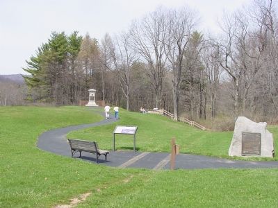
More about this marker. This marker is behind the Road to Disaster Marker, overlooking the trace of Braddock Road. His final resting place can be seen at the top of the steps that can be seen in Photograph Number 4.

Photographed By J. J. Prats, April 11, 2006
4. Braddock's Road Trace
The two wood beams embedded in the asphalt path mark the original Trace (trail) of Braddock's Road. This marker is out of frame on the right, at the bottom of the steps you see in the background. Braddock's original grave is along the trace in the woods through the break in the trees. He is now buried in under the monument that can be seen in the distance to the left.
Credits. This page was last revised on February 7, 2023. It was originally submitted on May 7, 2006, by J. J. Prats of Powell, Ohio. This page has been viewed 4,640 times since then and 18 times this year. Photos: 1, 2, 3. submitted on May 7, 2006, by J. J. Prats of Powell, Ohio. 4. submitted on April 29, 2006, by J. J. Prats of Powell, Ohio.


