Near Trading Post in Linn County, Kansas — The American Midwest (Upper Plains)
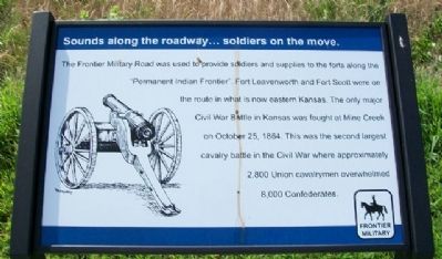
Sounds along the roadway...soldiers on the move.
Frontier Military Historic Byway
Inscription.
The Frontier Military Road was used to provide soldiers and supplies to the forts along the "Permanent Indian Frontier". Fort Leavenworth and Fort Scott were on the route in what is now eastern Kansas. The only major Civil War Battle in Kansas was fought at Mine Creek on October 25, 1864. This was the second largest cavalry battle in the Civil War where approximately 2,800 Union cavalrymen overwhelmed 8,000 Confederates.
Erected 2010 by Frontier Military Historic Byway.
Topics. This historical marker is listed in these topic lists: Roads & Vehicles • Settlements & Settlers • War, US Civil. A significant historical month for this entry is October 1820.
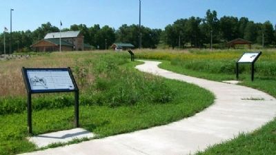
Location. 38° 15.546′ N, 94° 40.311′ W. Marker is near Trading Post, Kansas, in Linn County. Marker is at the Kansas DOT rest area, located about 1500 feet SSE of the intersection of US Highway 69 and Kansas Highway 52. Touch for map. Marker is in this post office area: Pleasanton KS 66075, United States of America. Touch for directions.
Other nearby markers. At least 8 other markers are within walking distance of this marker. Sounds along the byway...saws, picks and axes. (a few steps from this marker); Sounds along the byway...anxiety and anticipation in the creak of wagon wheels. (within shouting distance of this marker); Sounds along the byway...fur traders bringing their goods. (within shouting distance of this marker); Sounds from the past...hoof beats and heartbeats. (within shouting distance of this marker); Sounds along the byway...auto, trucks and buses. (within shouting distance of this marker); Sounds of the byway...moccasins and tears. (within shouting distance of this marker); Marais Du Cygne Martyrs Memorial (approx. 0.7 miles away); Marais des Cygnes Massacre (approx. 0.7 miles away). Touch for a list and map of all markers in Trading Post.
Also see . . .
1. Frontier Military Historic Byway. (Submitted on August 2, 2010, by William Fischer, Jr. of Scranton, Pennsylvania.)
2. The Military Road and the Founding of Fort Scott. (Submitted on August 2, 2010, by William Fischer, Jr. of Scranton, Pennsylvania.)
3. Visit Mine Creek Civil War Battlefield. Kansas Historical Society entry (Submitted on December 27, 2020, by Larry Gertner of New York, New York.)
Credits. This page was last revised on December 27, 2020. It was originally submitted on August 2, 2010, by William Fischer, Jr. of Scranton, Pennsylvania. This page has been viewed 876 times since then and 9 times this year. Photos: 1, 2. submitted on August 2, 2010, by William Fischer, Jr. of Scranton, Pennsylvania.

