
Greensboro in Caroline County, Maryland — The American Northeast (Mid-Atlantic)
Greensboro
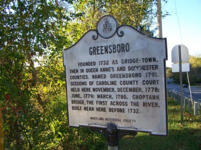
Photographed by Beverly Pfingsten, November 3, 2007
1. Greensboro Marker
Erected 1967 by Maryland Historical Society.
Topics and series. This historical marker is listed in these topic lists: Colonial Era • Notable Events • Settlements & Settlers. In addition, it is included in the Maryland Historical Trust series list. A significant historical date for this entry is March 17, 1780.
Location. 38° 58.393′ N, 75° 47.956′ W. Marker is in Greensboro, Maryland, in Caroline County. It is at the intersection of East Sunset Avenue (Maryland Route 314) and Greensboro Road ( Route 313), on the right when traveling west on East Sunset Avenue. Touch for map. Marker is in this post office area: Greensboro MD 21639, United States of America. Touch for directions.

Regionally, this marker is on the Eastern Shore. It is also in the American Mid-Atlantic, on the Delmarva Peninsula, in the Tidewater, and on the Eastern Seaboard. Globally, it
this page online
Other nearby markers. At least 8 other markers are within 5 miles of this marker, measured as the crow flies: Choptank River Park (about 500 feet away, measured in a direct line); Letter to Lincoln (approx. 0.3 miles away); Peter Harrington (approx. 0.3 miles away); Greensboro Veterans Memorial Park (approx. 0.4 miles away); Goldsborough House (approx. 0.4 miles away); Home of Judge Thomas White (approx. 4.7 miles away in Delaware); Saulsbury House - Fifer Hospital - Ridgely House (approx. 4.9 miles away); Town of Ridgely Flag (approx. 4.9 miles away). Touch for a list and map of all markers in Greensboro.
Another marker is no longer nearby. Greensboro (was approx. 0.3 miles away but has been confirmed missing).
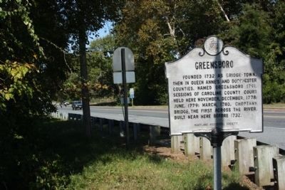
Photographed by Mike Stroud, October 9, 2010
2. Greensboro Marker, seen at MD 313, northbound
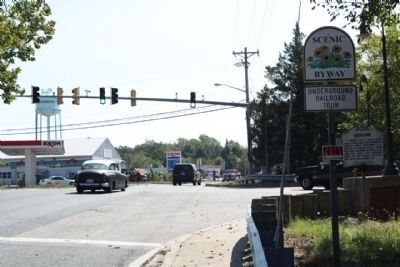
Photographed by Mike Stroud, October 9, 2010
3. Greensboro Marker, seen at intersection MD 314 and southbound MD 313
Credits. This page was last revised on December 21, 2024. It was originally submitted on November 7, 2007, by Bill Pfingsten of Bel Air, Maryland. This page has been viewed 1,751 times since then and 44 times this year. Photos: 1. submitted on November 7, 2007, by Bill Pfingsten of Bel Air, Maryland. 2, 3. submitted on October 18, 2010, by Mike Stroud of Bluffton, South Carolina.
