Sterling Heights in Macomb County, Michigan — The American Midwest (Great Lakes)
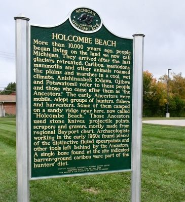
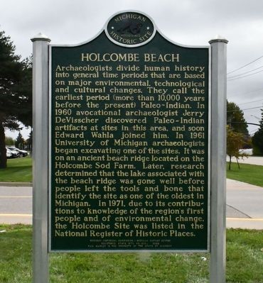
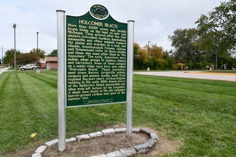
Holcombe Beach
Archaeologists divide human history into general time periods that are based on major environmental, technological and cultural changes. They call the earliest period (more than 10,000 years before the present) Paleo-Indian. In 1960 avocational archaeologist Jerry DeVisscher discovered Paleo-Indian artifacts at sites in this area, and soon Edward Wahla joined him. In 1961 University of Michigan archaeologists began excavating one of the sites. It was on an ancient beach ridge located on the Holcombe Sod Farm. Later, research determined that the lake associated with the beach ridge was gone well before people left the tools and bone that identify the site as one of the oldest in Michigan. In 1971, due to its contributions to knowledge of the region's first people and of environmental change, the Holcombe Site was listed in the National Register of Historic Places.
Erected 1978 by Michigan Historical Commission - Michigan Historical Center. Registered State Site No. 309. (Marker Number 309.)
Topics and series. This historical marker is listed in these topic lists: Anthropology & Archaeology • Native Americans. In addition, it is included in the Michigan Historical Commission series list.
Location. 42° 34.176′ N, 83° 0.613′ W. Marker is in Sterling Heights, Michigan, in Macomb County. Marker is on Dodge Park Road, 0.3 miles north of Metropolitan Parkway (16 Mile Road), on the right when traveling north. Touch for map. Marker is at or near this postal address: 37400 Dodge Park Road, Sterling Heights MI 48312, United States of America. Touch for directions.
Other nearby markers. At least 8 other markers are within 4 miles of this marker, measured as the crow flies. Upton House (approx. 1½ miles away); Red Run (approx. 3.2 miles away); a different marker also named Red Run (approx. 3.2 miles away); Village/Eckstein Park (approx. 3.4 miles away); Murthum-Vander Vlucht House (approx. 3.4 miles away); Red Run Creek (approx. 3.4 miles away); The Claeys House (approx. 3.4 miles away); a different marker also named Red Run Creek (approx. 3.4 miles away).
More about this marker. This marker was initially installed in Feb. 1978 nearby, near 42° 34' 8.868" N, 83° 0' 36.18" W. It was updated and replaced in Feb. 2023. Its original text—same on both sides—read,
Near this site in 1961 archaeologists from the Aboriginal Research Club and the University of Michigan uncovered evidence of an early Paleo-Indian settlement. Here about 11,000 years ago these first prehistoric dwellers in the Great Lakes region inhabited a lake shore. Excavations of artifacts and bones reveal that for food the Paleo-Indians hunted Barren Ground caribou, a species suited to the tundra-like terrain of that era. As their environment changed, these Indians were forced to adapt to new ways of living. Different climate and sources of food required modified tools and methods of subsistence and the Paleo-Indian pattern of life developed into the culture of the Early Archaic people. The site known as Holcombe Beach is a reminder of basic changes in Michigan’s physical and biological environment over the ages.
Credits. This page was last revised on November 2, 2023. It was originally submitted on August 9, 2010, by Joel Seewald of Madison Heights, Michigan. This page has been viewed 2,213 times since then and 58 times this year. Last updated on October 25, 2023, by Melanie Davis of Sterling Heights, Michigan. Photos: 1, 2, 3. submitted on October 25, 2023, by Melanie Davis of Sterling Heights, Michigan. 4. submitted on August 9, 2010, by Joel Seewald of Madison Heights, Michigan. • J. J. Prats was the editor who published this page.


