Near Williamsville in Bath County, Virginia — The American South (Mid-Atlantic)
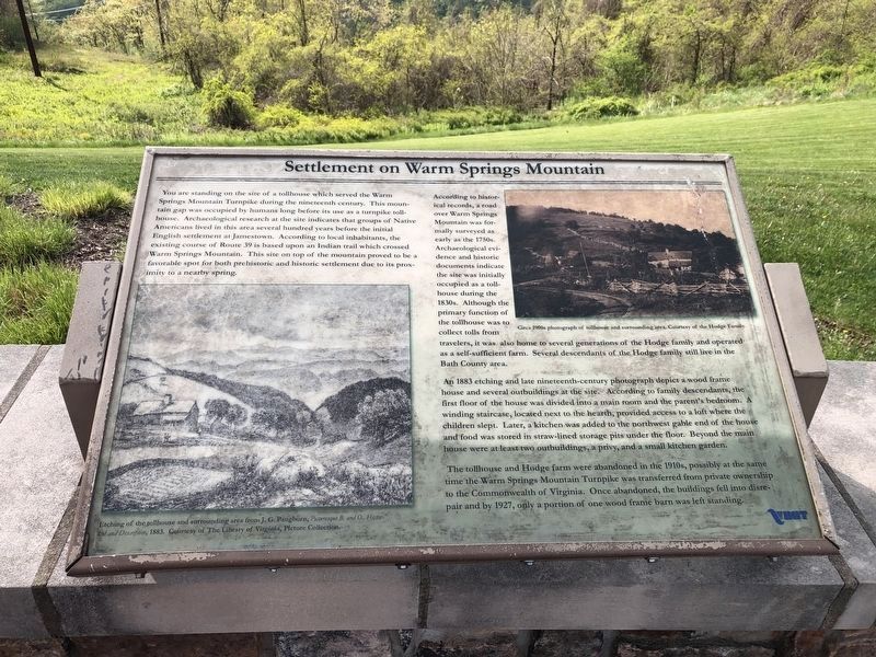
Settlement on Warm Springs Mountain
You are standing on the site of a tollhouse which served the Warm Springs Mountain Turnpike during the nineteenth century. This mountain gap was occupied by humans long before its use as a turnpike tollhouse. Archaeological research at the site indicates that groups of Native Americans lived in this area several hundred years before the initial English settlement at Jamestown. According to local inhabitants, the existing course of Route 39 is based upon an Indian trail which crossed Warm Springs Mountain. This site on top of the mountain proved to be a favorable spot for both prehistoric and historic settlement due to its proximity to a nearby spring.
According to historical records, a road over Warm Springs Mountain was formally surveyed as early as the 1750s. Archeological evidence and historic documents indicate the site was initially occupied as a tollhouse during the 1830s. Although the primary function of the tollhouse was to collect tolls from travelers, it was also home to several generations of the Hodge family and operated as a self-sufficient farm. Several descendants of the Hodge family still live in the Bath County area.
An 1883 etching and late nineteenth-century and late nineteenth-century photograph depict a wood frame house and several outbuildings at the site. According to family descendants, the first floor of the house was divided into a main room and the parent's bedroom. A winding staircase, located next to the hearth, provided access to a loft where the children slept. Later, a kitchen was added to the northwest gable end of the house and food was stored in straw-lined storage pits under the floor. Beyond the main house were at least two outbuildings, a privy, and a small kitchen garden.
The tollhouse and Hodge farm were abandoned in the 1910s, possibly at the same time the Warm Springs Mountain Turnpike was transferred from private ownership to the Commonwealth of Virginia. Once abandoned, the buildings fell into disrepair and by 1927, only a portion of one wood frame barn was left standing.
Erected by Virginia Department of Transportation.
Topics. This historical marker is listed in these topic lists: Native Americans • Roads & Vehicles • Settlements & Settlers. A significant historical year for this entry is 1883.
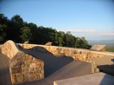
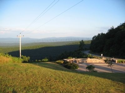
Location. 38° 3.064′ N, 79° 45.962′ W. Marker is near Williamsville, Virginia, in Bath County. Marker is at the intersection of State Highway 39 and Homestead Mountain Drive, on the right when traveling west on State Highway 39. Located at the Dan Ingalls Overlook in George Washington National Forest. Touch for map. Marker is in this post office area: Williamsville VA 24487, United States of America. Touch for directions.
Other nearby markers. At least 8 other markers are within walking distance of this marker. The Virginia Springs Resorts (here, next to this marker); The Land and Natural Resources of Bath County (a few steps from this marker); Life at the Tollhouse (a few steps from this marker); The Turnpike Movement in Virginia, 1825-1835 (a few steps from this marker); The Rev. Dr. William H. Sheppard (approx. 0.8 miles away); Early Bath County Courthouses (approx. 0.8 miles away); Terrill Hill (approx. 0.8 miles away); Warm Springs Baths (approx. 0.8 miles away). Touch for a list and map of all markers in Williamsville.
Credits. This page was last revised on December 12, 2023. It was originally submitted on August 10, 2010, by Craig Swain of Leesburg, Virginia. This page has been viewed 1,020 times since then and 42 times this year. Photos: 1. submitted on May 9, 2021, by Devry Becker Jones of Washington, District of Columbia. 2, 3. submitted on August 10, 2010, by Craig Swain of Leesburg, Virginia.


