Near Hulett in Crook County, Wyoming — The American West (Mountains)
Devils Tower
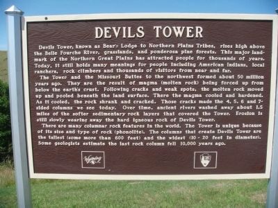
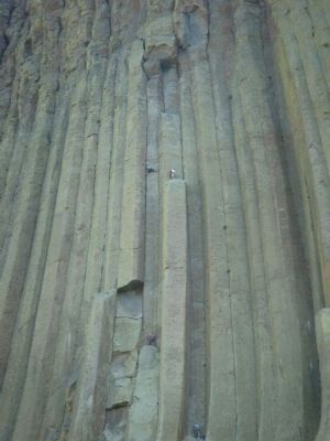
The Tower and the Missouri Buttes to the northwest formed about 50 million years ago. They are the result of magma (molten rock) being forced up from below the earth's crust. Following cracks and weak spots, the molten rock moved up and pooled beneath the land surface. There the magma cooled and hardened. As it cooled, the rock shrank and cracked. Those cracks made the 4, 5, 6 and 7-sided columns we see today. Over time, ancient rivers washed away about 1.5 miles of the softer sedimentary rock layers that covered the Tower. Erosion is still slowly wearing away the hard igneous rock of Devils Tower.
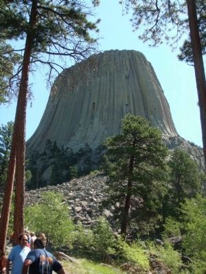
There are many columnar rock features in the world. The Tower is unique because of its size and type of rock (phonolite). The columns that create Devils Tower are the tallest (some more than 600 feet) and the widest (10-20 feet in diameter). Some geologists estimate the last rock column fell 10,000 years ago.
Erected by the State of Wyoming and the National Park Service.
Topics. This historical marker is listed in these topic lists: Landmarks • Native Americans • Science & Medicine.
Location. 44° 42.067′ N, 104° 29.073′ W. Marker is near Hulett, Wyoming, in Crook County. Marker is on State Highway 24, one mile west of Mona Belle Road, on the right when traveling west. Touch for map. Marker is in this post office area: Hulett WY 82720, United States of America. Touch for directions.
Other nearby markers. At least 3 other markers are within 14 miles of this marker, measured as the crow flies. Custer's 1874 Expedition (approx. 7.1 miles away); a different marker also named Devils Tower (approx. 13.9 miles away); a different marker also named Devils Tower (approx. 13.9 miles away).
Photographed By William J. Toman, August 12, 2010
6. Related Marker at Tower Visitors Center
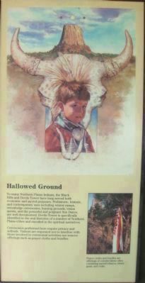
Hallowed Ground
To many Northern Plains Indians, the Black Hills and Devils Tower have long served both economic and sacred purposes. Prehistoric, historic, and contemporary uses including winter camps, sweatlodge ceremonies, hunting grounds, vision quests, and the powerful and poignant Sun Dance, are well documented. Devils Tower is specifically identified in the oral histories of a number of Northern Plains tribes and encoded in the spiritual narratives.
Ceremonies performed here require privacy and solitude. Visitors are requested not to interfere with those involved in ceremonial activities nor remove offerings such as prayer cloths and bundles.
Photo caption:Prayer cloths and bundles are offerings of colorful fabric, often containing sacred tobacco, sweet grass and cedar.
Photographed By William J. Toman, August 12, 2010
7. Related Marker at Tower Visitors Center
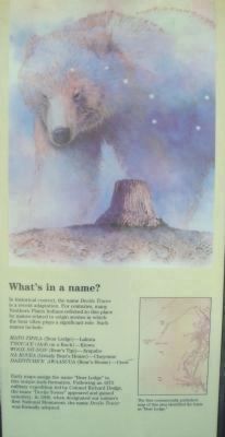
What's in a name?
In historical context, the name Devils Tower is a recent adaptation. For centuries, many Northern Plains Indians referred to this place by names related to origin stories in which the bear often plays a significant role. Such names include:
Mato Tipila (Bear Lodge)--Lakota
T'sou'a'e (Aloft on a Rock)--Kiowa
Woox-nii-non (Bear's Tipi)--Arapaho
Na kovea (Grizzly Bear's House)--Cheyenne
Daxpitche'e Awaasuua (Bear's House)--Crow
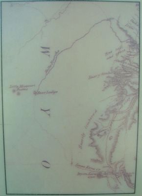
Early maps assign the name "Bear Lodge" to this unique rock formation. Following an 1873 military expedition led by Colonel Richard Dodge, the name "Devils Tower" appeared and gained notoriety. In 1906, when designated our nation's first National Monument, the name Devils Tower was formally adopted.
Photographed By William J. Toman, August 12, 2010
9. Related Marker on Tower Trail at Devils Tower
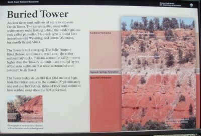
Buried Tower
Ancient rivers took millions of years to excavate Devils Tower. The waters carried away softer sedimentary rocks leaving behind the harder igneous rock called phonolite. This rock type is found here in northeastern Wyoming, and central Montana, but mostly in east Africa.
The Tower is still emerging. The Belle Fourche River (below) continues to wash away the softer sedimentary rocks. Plateaus across the valley--some higher than the Tower's summit--are eroded layers of the same sediment that once surrounded and covered Devils Tower.
The Tower today stands 867 feed (264 meters) high, from the visitor center to the summit. Approximately one and one-half vertical miles of rock and sediment have washed away since the Tower formed.
Lower photo caption: Photograph of modern river channel, with sedimentary rocks in background.
Right photo caption: Layers of sedimentary rock are exposed on a cliff near the Tower.
Layers in right photo from top to bottom:
Sundance Formation (Hulett Sandstone and Stockade Beaver Shale)
Gypsum Springs Formation
Spearfish Formation
Photographed By William J. Toman, August 12, 2010
10. Related Marker on Tower Trail at Devils Tower
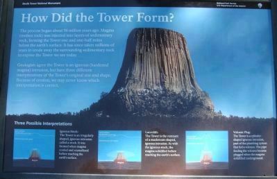
How Did the Tower Form?
The process began about 50 million years ago. Magma (molten rock) was injected into layers of sedimentary rock, forming the Tower one and one-half miles below the earth's surface. It has since taken millions of years to erode away the surrounding sedimentary rock to expose the Tower we see today.
Geologists agree the Tower is an igneous (hardened magma) intrusion, but have three different interpretations of the Tower's original size and shape. Because of erosion, we may never know which interpretation is correct.
Three Possible Interpretations
Igneous Stock: The Tower is an irregularly shaped, igneous intrusion called a stock. It was formed when magma cooled and crystallized before reaching the earth's surface.
Laccolith: The Tower is the remnant of a mushroom-shaped igneous intrusion. As with the igneous rock, the magma solidified before reaching the earth's surface.
Volcanic Plug: The Tower is a cylinder-shaped igneous intrusion, part of the plumbing system that fed a volcano. The pipe feeding the volcano became plugged when the magma solidified underground.
Photographed By William J. Toman, August 12, 2010
11. Related Marker on Tower Trail at Devils Tower
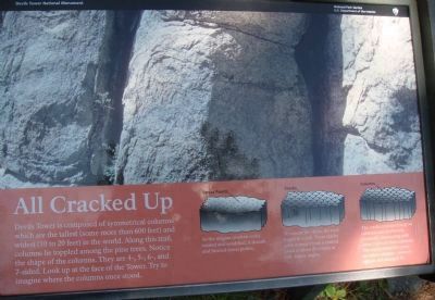
All Cracked Up
Devils Tower is composed of symmetrical columns which are the tallest (some more than 600 feet) and widest (10 to 20 feet) in the world. Along this trail, columns lie toppled among the pine trees. Notice the shape of the columns. They are 4-, 5-, 6-, and 7-sided. Look up at the face of the Tower. Try to imagine where the columns once stood.
Caption for first, "Stress Points," diagram: As the magma (molten rock) cooled and solidified, it shrunk and formed stress points.
Caption for second, "Cracks," diagram: To release the stress, the rock began to crack. These cracks grew outward from a central point in three directions at 120-degree angles.
Caption for third, "Columns," diagram: The cracks continued to grow outward and downward, eventually intersecting with other cracks to form columns. The cracks tended to create six-sided columns--nature's tightest and strongest fit.
Credits. This page was last revised on June 16, 2016. It was originally submitted on August 12, 2010, by William J. Toman of Green Lake, Wisconsin. This page has been viewed 2,081 times since then and 21 times this year. Last updated on August 15, 2010, by William J. Toman of Green Lake, Wisconsin. Photos: 1, 2, 3, 4, 5, 6, 7, 8. submitted on August 12, 2010, by William J. Toman of Green Lake, Wisconsin. 9, 10, 11. submitted on August 15, 2010, by William J. Toman of Green Lake, Wisconsin. • Kevin W. was the editor who published this page.
