Near Monterey in Highland County, Virginia — The American South (Mid-Atlantic)
Virginia
Highland County
Area 422 Square Miles
⎯⎯⎯
West Virginia
Photographed by Craig Swain, July 10, 2010
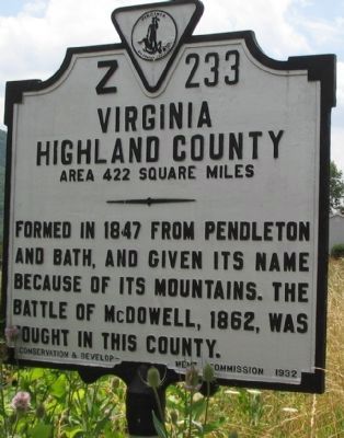
1. Highland County Side
Virginia. Highland County. Area 422 Square Miles. Formed in 1847 from Pendleton and Bath, and given its name because of its mountains. The battle of McDowell, 1862, was fought in this county.
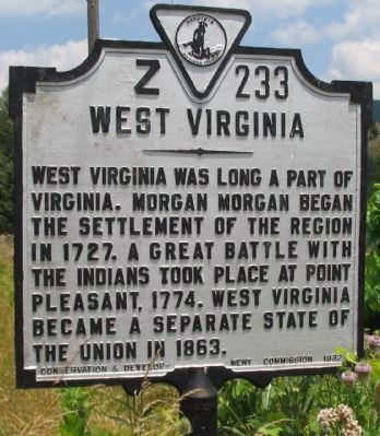
West Virginia. West Virginia was long a part of Virginia. Morgan Morgan began the settlement of the region in 1727. A great battle with the Indians took place at Point Pleasant, 1774. West Virginia became a separate state of the Union in 1863.
Erected 1932 by Conservation & Development Commission. (Marker Number Z-233.)
Topics and series. This historical marker is listed in these topic lists: Indigenous Peoples and Communities • Political Subdivisions • Settlements & Settlers • War, US Civil. In addition, it is included in the Virginia Department of Historic Resources (DHR) series list. A significant historical year for this entry is 1847.
Location. 38° 29.719′ N, 79° 29.908′ W. Marker is near Monterey, Virginia, in Highland County. It is on Potomac River Road (U.S. 220), on the right when traveling north. Touch for map. Marker is at or near this postal address: 7468 Potomac River Rd, Monterey VA 24465, United
this page online

Regionally, this marker is in the Shenandoah Valley, in the Alleghany Highlands, and specifically in the Potomac Highlands. It is also in the American South, specifically in the Upper South, in Appalachia, and specifically in Southern Appalachia. Globally, it is in North America, the Western Hemisphere, the Western World, and the Anglosphere. Historically, it finds itself in what was once the territory of the Mississippian Culture, one of the original Thirteen Colonies, one of the Confederate States of America, and the Antebellum South.
Other nearby markers. At least 8 other markers are within 8 miles of this marker, measured as the crow flies: West Virginia / Virginia (about 300 feet away, measured in a direct line in West Virginia); Johann Zacharias Rexrode, Jr. (approx. 7.2 miles away in West Virginia); Highland Inn (approx. 7.2 miles away); The Recorder (approx. 7.3 miles away); The Charles Pinckney Jones House (approx. 7.3 miles away); The Charles Pinckney Jones Law Office (approx. 7.3 miles away); a different marker also named Monterey (approx. 7.3 miles away); Walk of Honor
Photographed by Craig Swain, July 10, 2010
2. West Virginia Side
Other markers no longer nearby. Monterey (was approx. 7.3 miles away but has been replaced with another marker now near it); Town of Monterey (was approx. 7.3 miles away but has been replaced with another marker now near it).
Photographed by Craig Swain, July 10, 2010
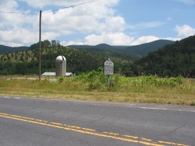
3. Highland County / West Virginia Marker
Credits. This page was last revised on August 6, 2026. It was originally submitted on August 17, 2010, by Craig Swain of Leesburg, Virginia. This page has been viewed 1,402 times since then and 51 times this year. Photos: 1, 2, 3. submitted on August 17, 2010, by Craig Swain of Leesburg, Virginia.
