Near Veedersburg in Fountain County, Indiana — The American Midwest (Great Lakes)
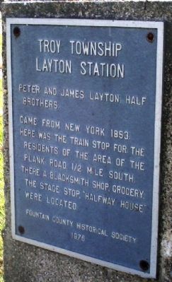
Troy Township, Layton Station
Erected 1976 by Fountain County Historical Society.
Topics. This historical marker is listed in these topic lists: Agriculture • Railroads & Streetcars • Roads & Vehicles • Settlements & Settlers. A significant historical year for this entry is 1853.
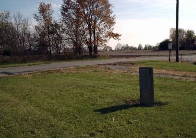
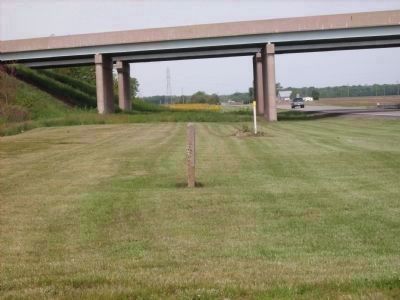
Location. 40° 7.487′ N, 87° 19.139′ W. Marker is near Veedersburg, Indiana, in Fountain County. Marker is at the intersection of U.S. 136 and South Layton Station Road, on the left when traveling west on U.S. 136. Aprox. 150 feet from I-74 Overpass (over US 136) half way between Veedersburg & Covington, Indiana. Touch for map. Marker is in this post office area: Veedersburg IN 47987, United States of America. Touch for directions.
Other nearby markers. At least 8 other markers are within 4 miles of this marker, measured as the crow flies. Veedersburg (approx. 2.6 miles away); Veedersburg " Scout Cabin " (approx. 2.8 miles away); Curfew Bell (approx. 2.8 miles away); Booe - Inlow - d'Arlier Cultural Center (approx. 3 miles away); Veedersburg Wabash Clay Company (approx. 3.1 miles away); Lee and Mike Ramsey (approx. 3.1 miles away); Nineteenth Century Functional Commercial Building (approx. 3.1 miles away); Veedersburg Memorial Park (approx. 3.1 miles away). Touch for a list and map of all markers in Veedersburg.
Regarding Troy Township, Layton Station. In his late twenties, James Layton came to Fountain County Indiana in 1851 by way of the Erie Canal from Broome County New York. He and his brother Peter Layton—who was 21 when he arrived in 1853 after his father died—was the youngest of eleven children.
A stagecoach ran on the “Plank Road” from the Erie Canal in Covington, which had been founded in 1826, to the community of Veedersburg, which was not yet an official town. Half way between Covington and (the future) Veedersburg on the Plank Road (now Dixie Bee Road & Layton Station Road), James Layton’s stagecoach stopped at the Halfway House—in reality just a shelter for the stagecoach to stop and rest the horses and give passengers respite from the bumpy ride on the wood planked road.
Most plank roads had toll houses to collect tolls to help pay for upkeep of the road and its planks. It is unknown if this was true of the Halfway House. This Plank Road evolved as U.S. 136 and was later called “Dixie Bee” as part of the National Dixie Highway system linking Chicago through Indianapolis to the Southern States. In the early 1900’s U.S. 136 was moved to its current alignment, leaving the Dixie Bee name and highway to the Fountain County Highway Department.
Located here near the Halfway House was the Brown School and later, “Ole Kentuck” organized as a Baptist Church. Eighth grade graduations from the school were held in the church which also served as a rural community center.
James and Peter Layton bought land at $3 per acre and established their farms.
In the 1860’s railroads were being laid through Indiana. Farmers donated right of ways and timber for railroad ties. Railroads had no passenger trains running on Sunday. However, “excursions” from Indianapolis to Urbana, Illinois, were a Sunday treat of a four hour trip one way.
This whistle stop—Layton Station—existed as the half way place for country folks. They could hop the train to Indianpolis or Urbana or points in between, get freight, ship crops, and also enjoy the Sunday Excursions.
U.S. 136 soon was relocated to its current alignment and a country grocery store developed from the efforts of James Layton’s son Fred. After many
years Fred moved his store to Covington and joined with William Bilsland to operate as the “Layton and Bilsland Grocery” for seventeen years prior to its closing.
Today blacktop pavement replaces the Dixie Bee’s planks, U.S. 136 is now over there, the buildings are gone, and the railway companies and their tracks are also gone. But left behind are fond memories—and the proud descendants of the original Laytons.
Additional keywords. Plank Road Dixie Highway Halfway House
Credits. This page was last revised on June 16, 2016. It was originally submitted on November 8, 2007, by Al Wolf of Veedersburg, Indiana. This page has been viewed 3,134 times since then and 20 times this year. Last updated on November 11, 2007, by Al Wolf of Veedersburg, Indiana. Photos: 1, 2. submitted on November 8, 2007, by Al Wolf of Veedersburg, Indiana. 3. submitted on May 25, 2008, by Al Wolf of Veedersburg, Indiana. • J. J. Prats was the editor who published this page.
Editor’s want-list for this marker. Old photos of the long-gone buildings, Dixie Bee highway signs, the railroad. • Can you help?


