French Quarter in New Orleans in Orleans Parish, Louisiana — The American South (West South Central)
Lower Pontalba Building
| — | Pontalba Buildings National Historic Landmark | — |
Photographed by Richard E. Miller, August 6, 2010
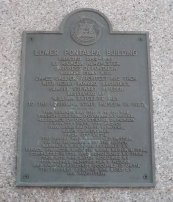
1. Lower Pontabla Building Marker
Erected 1850 - 1851
by Micaela Almonster Baroness De Pontalba
working first with James Gallier, architect,
and then with Henry Howard, architect. Samuel Stewart, builder.
Bequeathed by William Ratcliffe Irby to the Louisiana State Museum in 1927.
----
This corner was the site of the French colonial Government House, residence of Gov. Etienne De Perier from 1727 until 1731 and of Gov. Jean Baptiste LeMoyne, Sieur de Bienville from 1731 until the house was abandoned in 1738.
On the remainder of the block, barracks buildings designed by Ignace Francois Broutin were begun in 1734, completed in 1738 and demolished by 1759.
This site was later acquired by Don Andres Almonester y Roxas, and various buildings occupied it until the present building was built by his daughter.
Erected by Orleans Parish Landmarks Commission.
Topics and series. This historical marker is listed in these topic lists: Colonial Era • Settlements & Settlers • Women. In addition, it is included in the National Historic Landmarks series list. A significant historical year for this entry is 1850.
Location. 29° 57.496′ N,
this page online

Regionally, this marker is in one of the River Parishes. It is also in the American South, specifically in the Deep South, on the Gulf Coast, and in the Great River Road Region. Globally, it is in North America, a Gulf of Mexico state, the Western Hemisphere, the Western World, and the Anglosphere. Historically, it finds itself in what was once New Spain, the Viceroyalty of New France, the territory of the Mississippian Culture, the Louisiana Purchase, one of the Confederate States of America, and the Antebellum South.
Other nearby markers. At
Photographed by Richard E. Miller, August 6, 2010
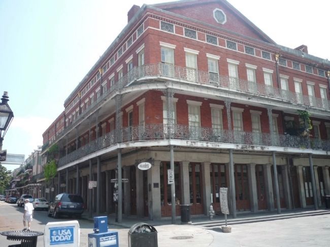
2. Lower Pontalba Building Marker
Related marker. Click here for another marker that is related to this marker. To better understand the relationship, study each marker in the order shown.
Also see . . . The 1850 House Museum in the Lower Pontalba Building. (Submitted on August 24, 2010, by Richard E. Miller of Oxon Hill, Maryland.)
Additional keywords. 1850 House; Louisiana State Museum.
Photographed by Richard E. Miller, August 6, 2010
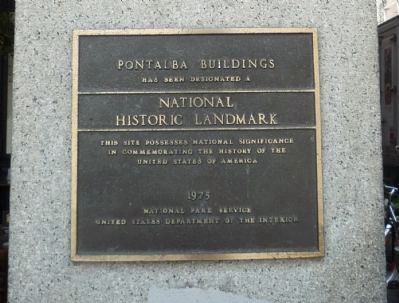
3. "Pontalba Buildings" National Historic Landmark
- the NHL Marker applicable to both Pontalba Buildings is displayed on the "Upper" building on St. Peter Street across Jackson Square.
Photographed by Richard E. Miller, August 6, 2010
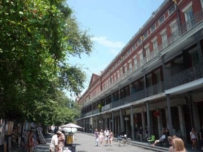
4. St. Ann Street
Jackson Square is on the left and Lower Pontalba, with the "1850 House Museum", on the right.
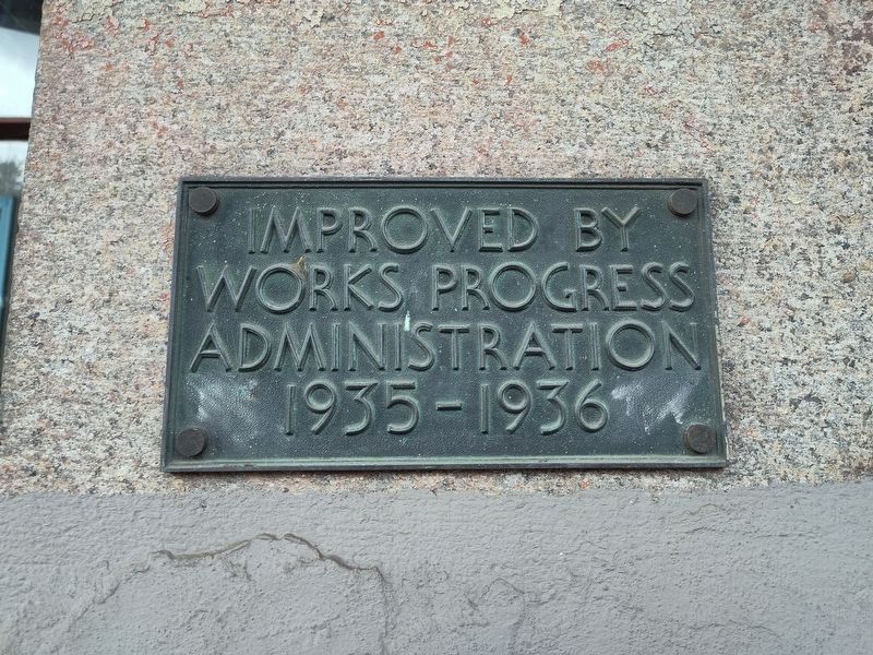
Photographed by Craig Doda, February 14, 2026
5. Lower Pontalba Building Marker

Photographed by Craig Doda, February 14, 2026
6. Lower Pontalba Building Marker
Credits. This page was last revised on March 2, 2026. It was originally submitted on August 24, 2010, by Richard E. Miller of Oxon Hill, Maryland. This page has been viewed 2,109 times since then and 47 times this year. Photos: 1, 2, 3, 4. submitted on August 24, 2010, by Richard E. Miller of Oxon Hill, Maryland. 5, 6. submitted on March 1, 2026, by Craig Doda of Napoleon, Ohio. • Bill Pfingsten was the editor who published this page.
