Brookline near Battlefield in Greene County, Missouri — The American Midwest (Upper Plains)
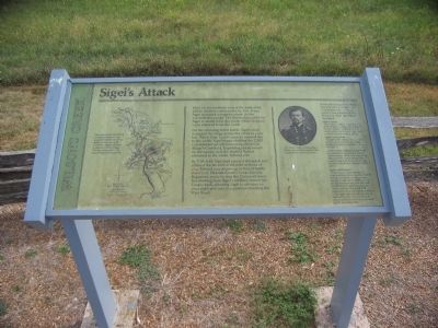
Sigel's Attack
Wilson's Creek
On the morning of the battle, Sigel's men occupied the ridge across the creek to your left. When Gen. Lyon's cannon opened fire to the north, Sigel began shelling the 2,300 Confederate cavalrymen camped here in Sharp's Cornfield. Exploding shells rained on the camps, and the startled Rebels retreated to the north, behind you.
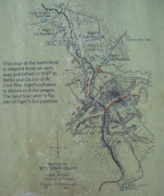
By 7:30 A.M. Sigel had crossed the creek and entered the far end of the field in front of you. Behind you, drawn up in line of battle stood Col. Elkanah Greer's Texas Cavalry Regiment, ready to stop the Union advance. But shelling from Sigel's artillery forced the Texans back, allowing Sigel to advance to your right and rear to a position blocking the Wire Road.
In his official report to Major General John C. Fremont, Commander of the Union Army's Department of the West, Col. Sigel described the attack:
Sigel's Orders
"According to orders, it was the duty of this brigade to attack the enemy in the rear, and to cut off his retreat which order I tried to exercise whatever the consequences might be."
Sigel's 1st Position
"In sight of the enemy's tents, which spread out in our front and right, I planted four pieces of artillery on a little hill..."
"I ordered the artillery to begin their fire against the camp of the enemy (Missourians), which was of so much effect, that the enemy troops were seen leaving their tents and retiring in haste toward the northeast of the valley."
Sigel's 2nd Position
"As the enemy made his rally in large numbers before us, about 3,000 strong, consisting of infantry and cavalry, I ordered the artillery to be brought forward from the hill, and formed them in battery across the valley, with the Third and Fifth Regiments to the left and the cavalry to the right. After an effective fire of half an hour the enemy retired in some confusion into the woods and up the adjoining hills."
Topics. This historical marker is listed in this topic list: War, US Civil.
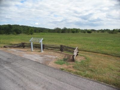
Location. 37° 5.486′ N, 93° 24.387′ W. Marker is near Battlefield, Missouri, in Greene County. It is in Brookline. Marker is on Tour Road, on the left when traveling west. Located at stop 4, the Sigel's Second Position, of the Wilson's Creek battlefield driving tour. Touch for map. Marker is in this post office area: Republic MO 65738, United States of America. Touch for directions.
Other nearby markers. At least 8 other markers are within walking distance of this marker. Rout of Sigel's Column (approx. 0.3 miles away); The Eye of the Storm (approx. 0.6
miles away); Price's Headquarters (approx. 0.7 miles away); Pulaski Arkansas Battery (approx. 0.7 miles away); A Union Plan / The Broken Pincer (approx. 0.7 miles away); a different marker also named Pulaski Arkansas Battery (approx. 0.8 miles away); Guibor's Battery (approx. 0.9 miles away); Death of Brigadier General Nathaniel Lyon (approx. one mile away). Touch for a list and map of all markers in Battlefield.
Also see . . . Wilson's Creek National Battlefield Park. (Submitted on September 2, 2010, by Craig Swain of Leesburg, Virginia.)
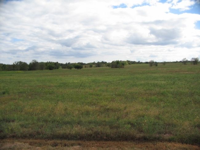
Photographed By Craig Swain, August 29, 2010
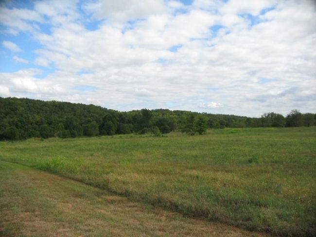
5. Sigel's Second Position
Crossing at Manley Ford, Sigel moved his command forward on the west side of Wilson's Creek. He moved over Turrell Creek (south of the park grounds), and into Sharp's fields. The 3rd and 5th Missouri Infantry, Backof's battery, and part of the 2nd US Cavalry formed a line across those fields seen in this view.
Credits. This page was last revised on February 16, 2023. It was originally submitted on September 2, 2010, by Craig Swain of Leesburg, Virginia. This page has been viewed 912 times since then and 35 times this year. Photos: 1, 2, 3, 4, 5. submitted on September 2, 2010, by Craig Swain of Leesburg, Virginia.
