Near Smithfield in Isle of Wight County, Virginia — The American South (Mid-Atlantic)
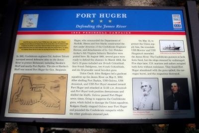
Fort Huger
Defending the James River
ó 1862 Peninsula Campaign ó
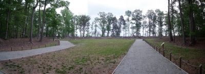
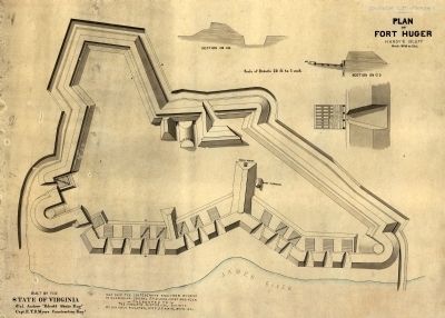
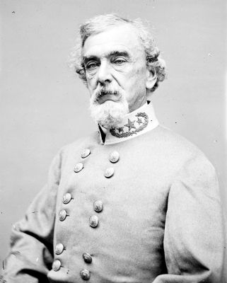
In 1861, Confederate engineer Col. Andrew Talcott surveyed several defensive sites on the James River to protect Richmond, including Hardenís Bluff and nearby Fort Boykin. The site at Hardenís Bluff was named Fort Huger for Gen. Benjamin Huger, who commanded the Department of Norfolk. Slaves and free blacks constructed the fort under direction of the Confederate Engineer Bureau, and detachments of Lt. Col. Fletcher Archerís 5th Virginia infantry Battalion were posted here. By August 1861, several guns were ready to defend the channel. In March 1862, the fortís 13 guns included one 10-inch Columbiad, four 9 inch Dahlgrens, two 8-inch Columbiads, and six 32-pounder naval hot-shot guns.
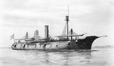
Union Cmdr. John Rodgers led a gunboat squadron up the James River on May 8, 1862. After shelling Fort Boykin, USS Galena, USS Aroostook, and USS Port Royal steamed toward Fort Huger and attacked at 11:20 A.M. Aroostook and Port Royal took position downstream and shelled the bluffs. Galena passed Fort Huger seven times, firing to suppress the Confederate guns, which failed to damage the Union squadron. Rodgers finally stopped Galena near Fort Huger and pounded the Confederate ramparts while the other gunboats steamed past.
On May 12, to protect the Union supply line, the ironclads USS Monitor and USS Naugatuck ascended the James River. The Confederate gunners at both forts fired, but the ships steamed by undamaged. Five days later, U.S. marines and sailors occupied both forts without resistance. They found Fort Huger abandoned with the guns spiked, the carriages burnt, and the magazines destroyed.
(captions)
USS Galena, by Oscar Parkes
Gen. Benjamin Huger Courtesy Library of Congress
Col. Andrew Talcott Courtesy Smithsonian Institution
Erected 2010 by Virginia Civil War Trails.
Topics and series. This historical marker is listed in these topic lists: Forts and Castles • War, US Civil • Waterways & Vessels. In addition, it is included in the Virginia Civil War Trails series list. A significant historical date for this entry is May 8, 1862.
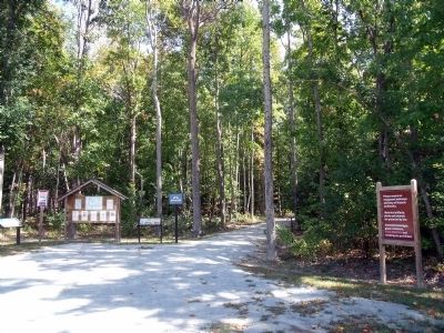
Location. This marker has been replaced by another marker nearby. It was located near 37° 6.668′ N, 76° 39.693′ W. Marker was near Smithfield, Virginia, in Isle of Wight County. Marker could be reached from the intersection of Talcott Terrace and Lawnes Neck Drive, on the right when traveling east. Touch for map. Marker was at or near this postal address: 15080 Talcott Ter, Smithfield VA 23430, United States of America. Touch for directions.
Other nearby markers. At least 8 other markers are within walking distance of this location. A different marker also named Fort Huger (here, next to this marker); Welcome to Fort Huger (a few steps from this marker); a different marker also named Fort Huger (a few steps from this marker); Encampment (within shouting distance of this marker); Fifth Battalion Virginia Infantry (within shouting distance of this marker); Bridge (about 500 feet away, measured in a direct line); Fort Entrance & Defense (approx. 0.2 miles away); The Fort (approx. 0.2 miles away). Touch for a list and map of all markers in Smithfield.
Related marker. Click here for another marker that is related to this marker. New CWT Marker At This Location also titled Fort Huger.
Also see . . .
1. Historic Fort Huger. Smithfield & Isle of Wight Convention & Visitors Bureau (Submitted on September 19, 2010.)
2. Fort Huger. National Register of Historic Places (Submitted on September 20, 2010.)
Credits. This page was last revised on April 7, 2024. It was originally submitted on September 19, 2010, by Bernard Fisher of Richmond, Virginia. This page has been viewed 1,596 times since then and 32 times this year. Photos: 1, 2, 3, 4, 5, 6, 7, 8. submitted on September 19, 2010, by Bernard Fisher of Richmond, Virginia.
