Near Petersburg in Dinwiddie County, Virginia — The American South (Mid-Atlantic)
Where Hill Fell

Photographed by Bill Coughlin, April 25, 2007
1. Where Hill Fell Marker
Erected 1929 by Conservation & Development Commission. (Marker Number S-49.)
Topics and series. This historical marker is listed in this topic list: War, US Civil. In addition, it is included in the Virginia Department of Historic Resources (DHR) series list. A significant historical date for this entry is April 2, 1864.
Location. 37° 11.348′ N, 77° 28.601′ W. Marker is near Petersburg, Virginia, in Dinwiddie County. It is on Boydton Plank Road (U.S. 1), on the right when traveling south. Touch for map. Marker is in this post office area: Petersburg VA 23803, United States of America. Touch for directions.

Regionally, this marker is in Virginia’s Piedmont, in Southside Virginia, and specifically in Central Virginia. It is also in the American South and specifically in the Upper South. Globally, it is in North America, the Western Hemisphere, the Western World, and the Anglosphere. Historically,
this page online
Other nearby markers. At least 8 other markers are within walking distance of this marker: A.P. Hill Memorial (about 400 feet away, measured in a direct line); Spot Where A.P. Hill Was Killed (approx. 0.3 miles away); The Breakthrough (approx. half a mile away); The Confederate Counterattack (approx. half a mile away); Pamplin Historical Park (approx. half a mile away); Lane’s North Carolina Brigade (approx. half a mile away); “Our Line of Battle was so Thin” (approx. half a mile away); 1st Lieutenant Evander McNair Robeson (approx. half a mile away). Touch for a list and map of all markers in Petersburg.
Another marker is no longer nearby. Pamplin Historical Park & The National Museum of the Civil War Soldier (was approx. 0.2 miles away but has been permanently removed).
Photographed by Bill Coughlin, April 25, 2007
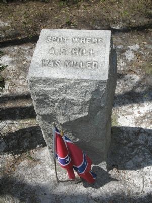
2. Spot where AP Hill was killed
This monument is located in the woods, just north of the marker.
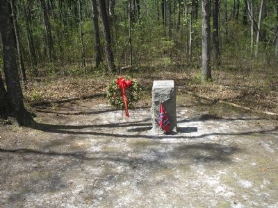
Photographed by Bill Coughlin, April 25, 2007
3. AP Hill's actual death site.
Photographed by Bill Coughlin, April 21, 2007
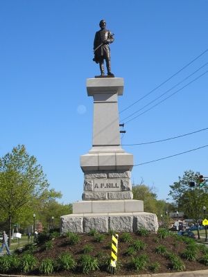
4. A.P. Hill's grave in Richmond
Photographed by Bill Coughlin, April 21, 2007
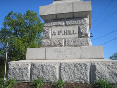
5. Detail of AP Hill's grave marker
The grave of General A. P. Hill notes that he was killed before Petersburg, April 2, 1865.
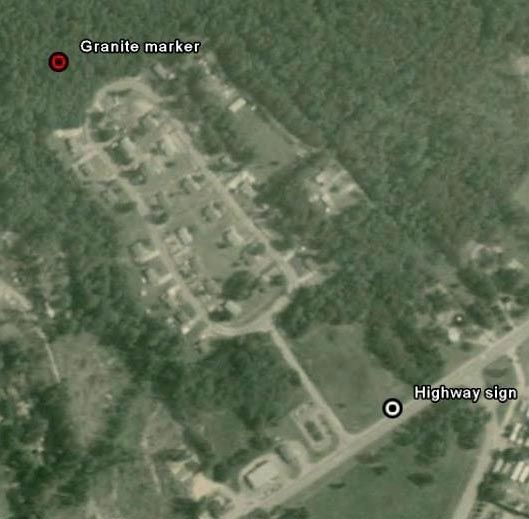
Photographed by Google Maps, March 20, 2008
6. Aerial view of roadside historical marker and nearby granite death spot memorial locations
The granite marker commemorating the actual spot of Hill's death is located about 1/3 mile away from the highway sign, in a forested area just off the road in the nearby housing development. Use these coordinates ( N 37° 11.553 W 077° 28.847 ) and look for the Civil War Preservation Trust signs affixed to the trees as a clue you are getting close.
Credits. This page was last revised on October 2, 2025. It was originally submitted on November 17, 2007, by Bill Coughlin of Woodland Park, New Jersey. This page has been viewed 4,682 times since then and 111 times this year. Photos: 1, 2, 3, 4, 5. submitted on November 17, 2007, by Bill Coughlin of Woodland Park, New Jersey. 6. submitted on March 27, 2008, by Harold Colson of San Diego, California. • J. J. Prats was the editor who published this page.
