Marion in Smyth County, Virginia — The American South (Mid-Atlantic)
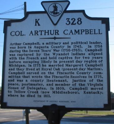
Col. Arthur Campbell
Erected 2006 by Department of Historic Resources. (Marker Number K-328.)
Topics and series. This historical marker is listed in these topic lists: Colonial Era • Government & Politics • War, French and Indian • War, US Revolutionary. In addition, it is included in the Virginia Department of Historic Resources (DHR) series list. A significant historical year for this entry is 1743.
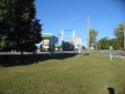
Location. 36° 50.655′ N, 81° 30.106′ W. Marker is in Marion, Virginia, in Smyth County. Marker is at the intersection of North Main Street (U.S. 11) and Park Boulevard (State Highway 16), on the right when traveling south on North Main Street. Touch for map. Marker is in this post office area: Marion VA 24354, United States of America. Touch for directions.
Other nearby markers. At least 8 other markers are within 2 miles of this marker, measured as the crow flies. Site of Colonial Home (here, next to this marker); Royal Oak Presbyterian Church (approx. 0.3 miles away); Sherwood Anderson (approx. half a mile away); Battle of Marion (approx. ¾ mile away); Governor David Campbell (approx. 1.1 miles away); Annabel Morris Buchanan (approx. 1.1 miles away); Marion & Rye Valley Railroad (approx. 1.1 miles away); Nolan Ryan and the Marion Mets (approx. 1.1 miles away). Touch for a list and map of all markers in Marion.
Credits. This page was last revised on June 16, 2016. It was originally submitted on September 22, 2010, by Craig Swain of Leesburg, Virginia. This page has been viewed 1,518 times since then and 26 times this year. Photos: 1, 2. submitted on September 22, 2010, by Craig Swain of Leesburg, Virginia.

