Near LaGrange in Troup County, Georgia — The American South (South Atlantic)
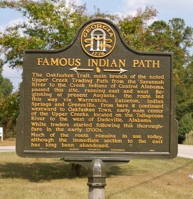
Famous Indian Path
<------->
White traders started following this thoroughfare on the early 1700s.
Much of the route remains in use today, although the immediate section to the east has long been abandoned.
Erected 1954 by Georgia Historical Commission. (Marker Number 141-4.)
Topics and series. This historical marker is listed in these topic lists: Native Americans • Roads & Vehicles. In addition, it is included in the Georgia Historical Society series list.
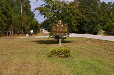
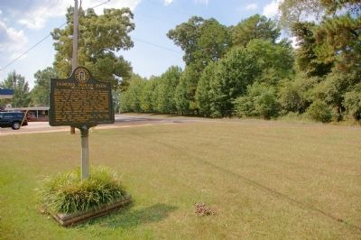
Location. 33° 0.444′ N, 85° 6.55′ W. Marker is near LaGrange, Georgia, in Troup County. Marker is at the intersection of West Point Road (U.S. 29) and Upper Glass Bridge Road, on the right when traveling west on West Point Road. Touch for map. Marker is in this post office area: Lagrange GA 30240, United States of America. Touch for directions.
Other nearby markers. At least 8 other markers are within 5 miles of this marker, measured as the crow flies. The Milstead Bell (approx. 4.1 miles away); LaGrange College – 1831 (approx. 4.3 miles away); a different marker also named LaGrange College – 1831 (approx. 4.3 miles away); Dr. Ulrich Bonnell Phillips (approx. 4˝ miles away); Bellevue (approx. 4.6 miles away); Bellevue, Home of Sen. Benjamin Harvey Hill (approx. 4.7 miles away); Mulberry Street Cemeteries (approx. 4.7 miles away); Horace King 1807-1885 (approx. 4.7 miles away). Touch for a list and map of all markers in LaGrange.
Credits. This page was last revised on June 16, 2016. It was originally submitted on September 25, 2010, by David Seibert of Sandy Springs, Georgia. This page has been viewed 1,474 times since then and 72 times this year. Photos: 1, 2, 3. submitted on September 25, 2010, by David Seibert of Sandy Springs, Georgia. • Craig Swain was the editor who published this page.


