Near Richmond in Henrico County, Virginia — The American South (Mid-Atlantic)
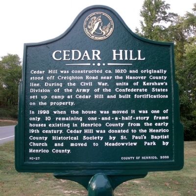
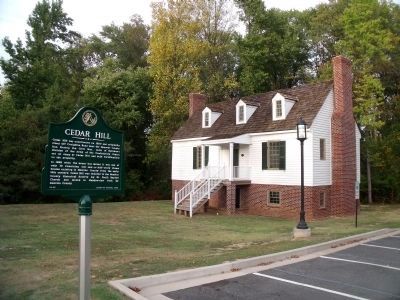
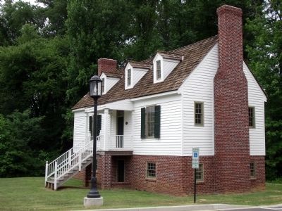
Cedar Hill
In 1998 when the house was moved it was one of only 10 remaining one-and-a-half-story frame houses existing in Henrico from the early 19th century. Cedar Hill was donated to the Henrico County Historical Society by St. Paul's Baptist Church and moved to Meadowview Park by Henrico County.
Erected 2009 by County of Henrico. (Marker Number HC-27.)
Topics. This historical marker is listed in this topic list: War, US Civil. A significant historical year for this entry is 1820.
Location. 37° 34.325′ N, 77° 21.746′ W. Marker is near Richmond, Virginia, in Henrico County. Marker is on Clarendon Road, 0.1 miles north of Mylan Road, on the right. This marker is located in Meadowview Park. Touch for map. Marker is at or near this postal address: 4001 Clarendon Road, Richmond VA 23223, United States of America. Touch for directions.
Other nearby markers. At least 8 other markers are within 2 miles of this marker, measured as the crow flies. John Marshall's Farm (approx. 0.2 miles away); Historic Cold Harbor Road (approx. 1.6 miles away); Holding the High Ground (approx. 1.6 miles away); Site of Ellerson’s Mill (approx. 1.6 miles away); Beaver Dam Creek (approx. 1.6 miles away); Lee’s First Strike (approx. 1.6 miles away); Ellerson's Mill (approx. 1.7 miles away); a different marker also named Beaver Dam Creek (approx. 1.7 miles away).
Also see . . .
1. Armour House and Gardens at Meadowview Park. Henrico County Recreation & Parks (Submitted on September 29, 2010, by Bernard Fisher of Richmond, Virginia.)
2. Past Preservation - Cedar Hill & Armour House. Henrico County Historical Society (Submitted on September 29, 2010, by Bernard Fisher of Richmond, Virginia.)
Credits. This page was last revised on July 31, 2020. It was originally submitted on September 29, 2010, by Bernard Fisher of Richmond, Virginia. This page has been viewed 1,026 times since then and 23 times this year. Photos: 1, 2, 3. submitted on September 29, 2010, by Bernard Fisher of Richmond, Virginia.


