Near Lanett in Chambers County, Alabama — The American South (East South Central)
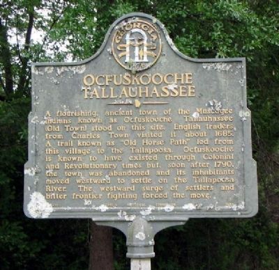
Ocfuskooche Tallauhassee
Photographed by David Seibert, April 30, 2006
1. Ocfuskooche Tallauhassee Marker
Erected 1956 by Georgia Historical Commission. (Marker Number 141-10.)
Topics. This historical marker is listed in these topic lists: Colonial Era • Indigenous Peoples and Communities. A significant historical year for this entry is 1685.
Location. 32° 54.766′ N, 85° 11.626′ W. Marker is near Lanett, Alabama, in Chambers County. It is on State Line Road (County Route 212) 0.1 miles south of North State Line Road, on the right when traveling north. Touch for map. Marker is in this post office area: Lanett AL 36863, United States of America. Touch for directions.

Regionally, this marker is in East Alabama.
this page online
Other nearby markers. At least 8 other markers are within 3 miles of this marker, measured as the crow flies: Fort Tyler (approx. 2.2 miles away in Georgia); More Enduring Than Marble (approx. 2.2 miles away in Georgia); a different marker also named Fort Tyler (approx. 2.3 miles away in Georgia); Battle of West Point (approx. 2.6 miles away in Georgia); "Daughters of the Confederacy" (approx. 2.6 miles away in Georgia); Gen. Robert C. Tyler, C.S.A. (approx. 2.7 miles away in Georgia); Fort Tyler Cemetery (approx. 2.7 miles away in Georgia); Lanier High School (approx. 2.8 miles away).
More about this marker. There is substantial evidence that the marker was originally erected (or intended to be erected) a short distance further north on State
Photographed by David Seibert, September 18, 2010
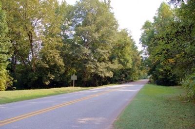
2. Ocfuskooche Tallauhassee Marker
Looking south on Chambers County (Alabama) Highway 212 toward West Point, Georgia
Credits. This page was last revised on June 16, 2016. It was originally submitted on December 26, 2008, by David Seibert of Sandy Springs, Georgia. This page has been viewed 3,409 times since then and 77 times this year. Last updated on September 30, 2010, by David Seibert of Sandy Springs, Georgia. Photos: 1. submitted on December 26, 2008, by David Seibert of Sandy Springs, Georgia. 2. submitted on September 30, 2010, by David Seibert of Sandy Springs, Georgia. • Bill Pfingsten was the editor who published this page.
