Near Fredericksburg in Spotsylvania County, Virginia — The American South (Mid-Atlantic)
The First Day at Chancellorsville
Lee Seizes the Initiative
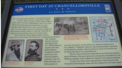
On May 1, 1863, Union Gen. Joseph Hooker ordered three columns to advance eastward on three roads: the River Road a mile to your left, the Plank Road a mile to your right, and the Orange Turnpike (present-day Route 3) to your immediate right. His goal was to move out of the Wilderness - a cut-over tangle of scrub trees and dense undergrowth that sometimes limited visibility to a few feet - and unite the columns on the open high ground a mile in front of you.
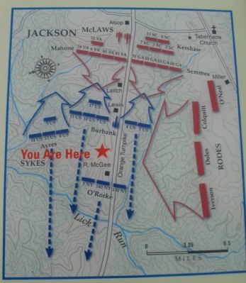
When Union Gen. George Sykes's infantry division arrived here on the turnpike from behind you, it encountered Confederate Gen. Lafayette McLaws's division approaching with Gen. William Mahone's brigade in the lead. Behind Mahone, Confederate artillery opened up on the advancing Federal regiments under Col. Sidney Burbank, and Union gunners to your rear returned fire. As the infantrymen clashed just ahead, part of Gen. Thomas J. "Stonewall" Jackson's corps threatened Sykes's right flank. In mid-afternoon, Hooker ordered his forces to retreat and entrench near the Chancellor House two miles behind you.
The First Day at Chancellorsville produced more than 500 casualties, deprived Hooker of the open high ground, and put him on the defensive in the Wilderness thickets. It also enabled Gen. Robert E. Lee to take the offensive.
To learn more about what happened here at the pivot point of the Chancellorsville Campaign, please take the walking tour that begins ahead.
Erected by Virginia Civil War Trails.
Topics and series. This historical marker is listed in this topic list: War, US Civil. In addition, it is included in the Virginia Civil War Trails series list. A significant historical month for this entry is May 1802.
Location. This marker has been replaced by another marker nearby. 38° 17.772′ N, 77° 35.785′ W. Marker is near Fredericksburg, Virginia, in Spotsylvania County. Marker is on Plank Road (State Highway 3), on the right when traveling east. This marker has been replaced by another marker at the same spot. It was located at the parking area for on a 140 acres tract preserved by Central Virginia Battlefields Trust. Touch for map. Marker is at or near this postal address: 6161 Plank Road, Fredericksburg VA 22407, United States of America. Touch for directions.
Other nearby markers. At least 8 other markers are within walking distance of this location. A different marker also named First Day at Chancellorsville (here, next to this marker); Chancellorsville Campaign (here, next to this marker); a different marker also named Chancellorsville Campaign (here, next to this marker); a different marker also named First Day at Chancellorsville (approx. 0.2 miles away); a different marker also named First Day at Chancellorsville (approx. 0.2 miles away); a different marker also named First Day at Chancellorsville (approx. 0.2 miles away); a different marker also named First Day at Chancellorsville (approx. 0.3 miles away); a different marker also named First Day at Chancellorsville (approx. 0.3 miles away). Touch for a list and map of all markers in Fredericksburg.
More about this marker. On the lower left are portraits of Gens. William Mahone and George Sykes. In the upper center is sketch of "the 'Victorious Advance of Gen. Sykes' from the high ground behind you on May 1. This detail shows Sykes's men on the Orange Turnpike preparing for the fight." On the upper right is a tactical battle map of the fighting described in the text.
Regarding The First Day at Chancellorsville. This marker is grouped with the markers along McLaws Drive, Furnace Road, Sickles Drive, and East Jackson Trail, on the east side of the battlefield. See the McLaws's Line to Catharine Furnace Virtual Tour by Markers in the links section for a listing
of related markers on the tour.
Also see . . .
1. Central Virginia Battlefields Trust. The organization that worked to preserve this section of the battlefield. (Submitted on November 18, 2007, by Craig Swain of Leesburg, Virginia.)
2. Infantry fighting east of Lick Run. Part 10 of a series on the 1863 Battle of Chancellorsville by Historian Robert Krick. (Submitted on November 18, 2007, by Craig Swain of Leesburg, Virginia.)
3. Battle of Chancellorsville. National Park Service site. (Submitted on November 18, 2007, by Craig Swain of Leesburg, Virginia.)
4. The Chancellorsville Campaign "Trail Head". Look in the Links section for Virtual tours by markers of the Chancellorsville battlefield. (Submitted on November 18, 2007, by Craig Swain of Leesburg, Virginia.)
5. McLaws's Line to Catharine Furnace Virtual Tour by Markers. Spread across a two mile segment on the east side of the battlefield, this virtual tour by markers covers action from May 1-3, 1863. (Submitted on November 18, 2007, by Craig Swain of Leesburg, Virginia.)
6. The "New" Marker. A new marker replaced this one in 2008. (Submitted on September 13, 2008, by Craig Swain of Leesburg, Virginia.)

Photographed By Craig Swain, November 10, 2007
4. Jackson's First Day Flank Attack
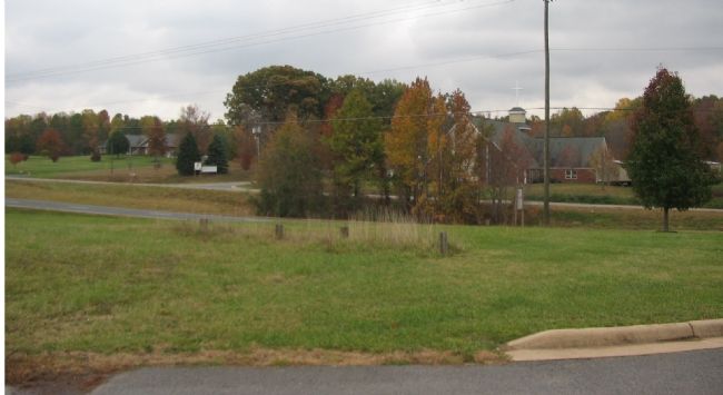
Looking across Virginia Highway 3, what was the Orange Pike at the time of the battle, at the approach direction of Jackson's attack. Confederate brigades of Iverson, Doles, and Colquitt attacked from this direction to drive back Burbank's Federals. The 2nd and 6th US Regulars occupied positions on the far side of the highway facing to the east (Fredericksburg) at the time.

Photographed By Craig Swain, November 10, 2007
5. Federal Positions
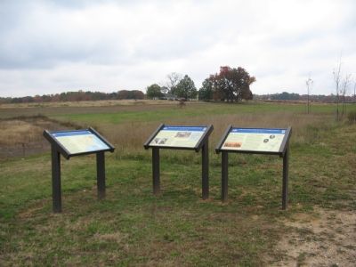
Looking east from the marker, Burbank's Brigade of U.S. Regulars occupied the field here confronting Mahone's Confederate Brigade advancing from the direction of Fredericksburg. Federal artillery occupied positions near the rise, along present day Virginia Highway 3, what was during the battle the Orange Turnpike.
Credits. This page was last revised on February 2, 2023. It was originally submitted on November 18, 2007, by Craig Swain of Leesburg, Virginia. This page has been viewed 1,417 times since then and 23 times this year. Photos: 1, 2, 3, 4, 5. submitted on November 18, 2007, by Craig Swain of Leesburg, Virginia.


