
Montgomery in Montgomery County, Alabama — The American South (East South Central)
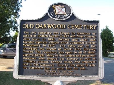
Old Oakwood Cemetery
Photographed by Lee Hattabaugh, October 1, 2010
1. Old Oakwood Cemetery Marker
(Continued on other side)
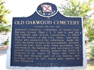
(Continued from other side)
Oakwood Cemetery, consisting of Scott's Free Burying Ground, Plats 1,2,3, and 4, and the old Catholic and Jewish cemeteries, is filled with the history of this City, State, and area. Those who pioneered the wilderness, made the early decisions, formed our government, promulgated our laws, bore our arms when necessary, and experienced the hardships and successes of our growth rest here. Having passed the torch of progress to us, many of those who were a living and integral part of our history and heritage have at last found safe harbor in
this page online
Erected by Alabama Historical Association Sponsored by the Montgomery Area Chamber of Commerce.
Topics and series. This historical marker is listed in these topic lists: Cemeteries & Burial Sites • Settlements & Settlers. In addition, it is included in the Alabama Historical Association series list. A significant historical year for this entry is 1817.
Location. 32° 22.954′ N, 86° 17.826′ W. Marker is in Montgomery, Alabama, in Montgomery County. It can be reached from Columbus Street east of North Ripley Street, on the right when traveling west. Note that Columbus Street is one-way going west, and can be accessed from Upper Wetumpka Road or a small extension of Jackson Street that goes through the police department parking lot. Marker is located on the left just inside the main gate of the Oakwood Cemetery. Touch for map. Marker is in this post office area: Montgomery AL 36104, United States of America. Touch for directions.

Regionally, this marker is in Alabama’s Tri-Counties River Region. It is also in the American South, specifically in the Deep South, and in the Black Belt. Globally, it is in North
Photographed by Lee Hattabaugh, October 1, 2010
2. Old Oakwood Cemetery Marker
Other nearby markers. At least 8 other markers are within walking distance of this marker: First Baptist Church (about 500 feet away); Civil War Medicine / Montgomery's Confederate Hospitals (about 600 feet away); William C. Oates (approx. 0.2 miles away); Governor William Calvin Oates / Colonel W. C. Oates, CSA at Gettysburg (approx. ¼ mile away); Alabama War Veterans Monument (approx. ¼ mile away); Cassimus House (approx. ¼ mile away); Ray W. Scott Jr. Founded Bass Anglers Movement (approx. 0.3 miles away); Sycamore Tree (approx. 0.3 miles away). Touch for a list and map of all markers in Montgomery.
Another marker is no longer nearby. Brigadier General Birkett Davenport Fry, CSA / Colonel B.D. Fry at Battle of Gettysburg (was about 400 feet away, measured in a direct line but has been confirmed missing).
Photographed by Lee Hattabaugh, October 1, 2010
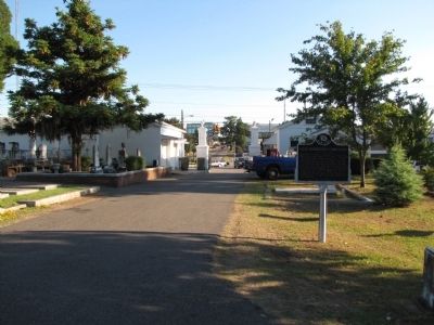
3. Old Oakwood Cemetery Marker
North Jackson Street and the police department parking lot can be seen outside the cemetery gates.
Credits. This page was last revised on June 16, 2016. It was originally submitted on October 4, 2010, by Lee Hattabaugh of Capshaw, Alabama. This page has been viewed 2,119 times since then and 51 times this year. Photos: 1, 2, 3. submitted on October 4, 2010, by Lee Hattabaugh of Capshaw, Alabama. • Craig Swain was the editor who published this page.
