Windsor in Essex County, Ontario — Central Canada (North America)
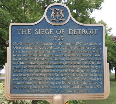
The Siege of Detroit 1763
Shortly after the founding of Detroit in 1701 a village of Ottawa Indians was established on the south shore of the river in this vicinity and its inhabitants lived on friendly terms with the French garrison and settlers. However after the British took control of Detroit and other western posts in 1760, relations with the Indians deteriorated. In 1763 the great Ottawa chief, Pontiac, raised a strong confederacy of Indian tribes and attacked several British posts. Detroit was besieged from May until October by a force which included some 250 warriors from this Ottawa village. Pontiac's unsuccessful attempt to capture Detroit led to the failure of his uprising and general peace was re-established in 1765.
Erected 1963 by Archaelogical and Historic Sites Board of Ontario.
Topics. This historical marker is listed in these topic lists: Colonial Era • Native Americans. A significant historical year for this entry is 1970.
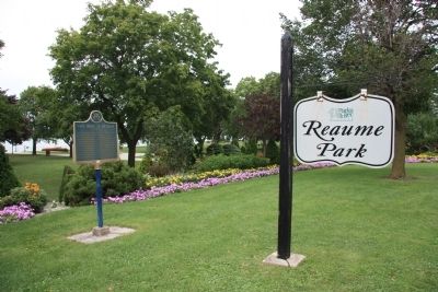
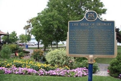
Location. 42° 19.711′ N, 82° 58.875′ W. Marker is in Windsor, Ontario, in Essex County. Marker is on Riverside Drive East close to Pillette Road. This historical marker is located on the Canadian side of the Detroit River, across the river from Detroit, Michigan. It is situated near the Detroit River in the city of Windsor's Reaume Park. Touch for map. Marker is in this post office area: Windsor ON N8Y, Canada. Touch for directions.
Other nearby markers. At least 8 other markers are within walking distance of this marker. Flag Pole (approx. 0.7 kilometers away in the U.S.); S.S. William Clay Ford / U.S.S. Yantic (approx. 0.7 kilometers away in the U.S.); S.S. Edmund Fitzgerald (approx. 0.8 kilometers away in the U.S.); a different marker also named S.S. Edmund Fitzgerald (approx. 0.8 kilometers away in the U.S.); a different marker also named S.S. Edmund Fitzgerald (approx. 0.8 kilometers away in the U.S.); War of 1812 Cannons (approx. 0.8 kilometers away in the U.S.); Perry's Victory (approx. 0.8 kilometers away in the U.S.); History of the Canals (approx. 0.9 kilometers away in the U.S.).
Also see . . .
1. Pontiac's Rebellion. Ohio History Central website entry (Submitted on October 15, 2010, by Dale K. Benington of Toledo, Ohio.)
2. Pontiac's Rebellion. United States History website entry (Submitted on October 15, 2010, by Dale K. Benington of Toledo, Ohio.)
Credits. This page was last revised on April 6, 2023. It was originally submitted on October 14, 2010, by Dale K. Benington of Toledo, Ohio. This page has been viewed 1,459 times since then and 32 times this year. Photos: 1, 2, 3, 4, 5. submitted on October 15, 2010, by Dale K. Benington of Toledo, Ohio.


