Near Custer in Custer County, South Dakota — The American Midwest (Upper Plains)
Prescribed Fire
An Important Tool to Tame Wildfire
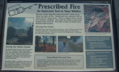
Serving the Forest
Prescribed fires revived the forest around you. How? Without natural fires the forest stagnated. Prescribed fires released locked up nutrients by turning plants into ash. Now soil is richer in treated areas. Prescribed fires also keep meadows open.
Saving the Visitor Center
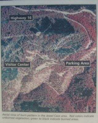
The National Park Service used fire against fire here. Starting in 1986, "prescribed fires" were ignited in surrounding patches of forest. Why? Without natural fires hotter, more destructive fires had become a dangerous possibility. Prescribed fires cleaned the forest.
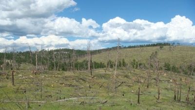
It worked! When a wildfire swept through the monument in 2000, it burned cooler in the treated forest patches. Prescribed fire helped these buildings survive a wildfire that elsewhere was an inferno.
Caption for center photos: Prescribed fires are carefully calculated events and conducted by trained fire professionals.
Prescribed Fire and You
Prescribed fire worked at Jewel Cave National Monument. Natural resource managers across the country use prescribed fire as a tool to tame wildfire. Has it been successfully used in your area? Talk to a park ranger to find out more about prescribed fires in National Parks.
Sidebar:
Before a prescribed fire is ignited certain environmental elements must fall within a predetermined "prescription":
• Weather (like wind conditions, temperature and humidity levels)
• Moisture levels in dead vegetation
• Quantity and availability of plant material for fuel
Prescribed fires are designed to achieve goals, such as:
• Reduce excessive amounts of dead vegetation
• Protect visitors, facilities and other resources from wildfire
• Improve wildlife habitat
• Kill exotic species
• Promote overall ecosystem health
Erected by the National Park Service of the U.S. Department of the Interior.
Topics. This historical marker is listed in these topic lists: Environment • Man-Made Features. A significant historical year for this entry is 1986.
Location. 43° 43.791′ N, 103° 49.779′ W. Marker is near Custer, South Dakota, in Custer County. Marker is at the intersection of U.S. 16 and Jewel Cave National Monument Entrance Road, on the left when traveling west on U.S. 16. The marker is
at the Jewel Cave National Monument Vistor Center. Touch for map. Marker is in this post office area: Custer SD 57730, United States of America. Touch for directions.
Other nearby markers. At least 7 other markers are within 12 miles of this marker, measured as the crow flies. Jasper vs. Jewel (here, next to this marker); Jasper Fire (approx. 1˝ miles away); Civilian Conservation Corps Camp (approx. 4.3 miles away); Comanche Park (approx. 5.8 miles away); Landscapes & Logging (approx. 11 miles away); Crazy Horse Memorial (approx. 11.3 miles away); The Hearst Highway (approx. 11.3 miles away).
Also see . . . Jewel Cave - National Park Service. (Submitted on October 26, 2010, by Bill Pfingsten of Bel Air, Maryland.)
Credits. This page was last revised on June 16, 2016. It was originally submitted on October 20, 2010, by William J. Toman of Green Lake, Wisconsin. This page has been viewed 652 times since then and 12 times this year. Photos: 1, 2, 3, 4. submitted on October 20, 2010, by William J. Toman of Green Lake, Wisconsin. • Bill Pfingsten was the editor who published this page.


