Spotsylvania Courthouse in Spotsylvania County, Virginia — The American South (Mid-Atlantic)
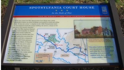
Spotsylvania Court House
In the Path of War
| — | Lee vs. Grant – The 1864 Campaign | — |
Photographed by Kevin W., November 18, 2007
1. Spotsylvania Court House Marker
The Civil War shattered Spotsylvania’s rural tranquility. In August 1862, Union troops raided the village, and nine months later Confederate authorities converted the courthouse yard into a temporary stockade to hold Union prisoners captured at the Battle of Chancellorsville. Worse was yet to come.
In May 1864, the Union and Confederate armies collided just outside the village. Spotsylvania was under fire for two weeks before the armies moved on. In their wake, they left battered buildings, miles of earthworks, and more than 30,000 casualties.
“The place looked quite desolate, very few persons remained and what few houses remained standing were pretty well riddled with shot and shell.”
- Union soldier, 1865.
Erected by Virginia Civil War Trails.
Topics and series. This historical marker is listed in these topic lists: Notable Events
this page online
Location. 38° 12.102′ N, 77° 35.337′ W. Marker is in Spotsylvania Courthouse, Virginia, in Spotsylvania County. It is on Courthouse Road (Virginia Route 208) near Brock Road, on the right when traveling south. Touch for map. Marker is at or near this postal address: 9102 Courthouse Rd, Spotsylvania VA 22553, United States of America. Touch for directions.

Regionally, this marker is in the Washington Metropolitan Area, in Northern Virginia, and in the Piedmont. It is also in the American South, specifically in the Upper South, in the Mid-Atlantic, and on the Eastern Seaboard. Globally, it is in the North Atlantic Region, North America, the Western Hemisphere, the Western World, and the Anglosphere. Historically, it finds itself in what was once the territory of the Mississippian Culture, one of the original Thirteen Colonies, one of the Confederate States of America, and the Antebellum South.
Other nearby markers. At least 8 other markers are within walking distance of this marker: A different marker also named Spotsylvania Court House
Photographed by Bill Coughlin, November 10, 2007
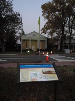
2. Marker at Spotsylvania Court House
The Spotsylvania Court House can be seen in this photo behind the marker.
Another marker is no longer nearby. A Crime of Passion… A Devastating Loss… (was a few steps from this marker but has been replaced with another marker now near it).
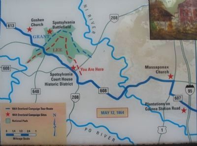
More about this marker. In the upper right George L. Frankenstein, a native German who served in the Union army, painted this watercolor of Spotsylvania Court House shortly after the war. Below the painting and in the center is a map of the area around Spotsylvania Court House with related sites indicated.
Photographed by Craig Swain, July 6, 2008
3. Close Up of the Map
Photographed by Kevin W., November 18, 2007
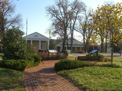
4. Spotsylvania Court House Marker
Photographed by Craig Swain, July 6, 2008
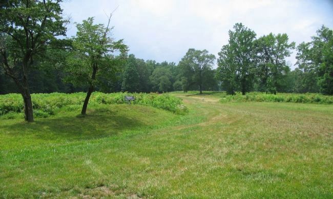
5. Entrenchments at Spotsylvania
A portion of the earthworks at the Mule Shoe, one of many field fortifications remaining from the fighting at Spotsylvania Court House.
Credits. This page was last revised on July 9, 2021. It was originally submitted on November 20, 2007, by Kevin W. of Stafford, Virginia. This page has been viewed 1,665 times since then and 35 times this year. Photos: 1. submitted on November 20, 2007, by Kevin W. of Stafford, Virginia. 2. submitted on January 11, 2009, by Bill Coughlin of Woodland Park, New Jersey. 3. submitted on August 13, 2008, by Craig Swain of Leesburg, Virginia. 4. submitted on November 20, 2007, by Kevin W. of Stafford, Virginia. 5. submitted on August 13, 2008, by Craig Swain of Leesburg, Virginia.
