Thomaston in Upson County, Georgia — The American South (South Atlantic)
Confederate Dead
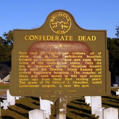
Photographed by David Seibert, October 30, 2010
1. Confederate Dead Marker
Erected 1956 by Georgia Historical Commission. (Marker Number 145-3.)
Topics and series. This historical marker is listed in these topic lists: Cemeteries & Burial Sites • War, US Civil. In addition, it is included in the Georgia Historical Society series list.
Location. 32° 53.031′ N, 84° 19.453′ W. Marker is in Thomaston, Georgia, in Upson County. It is on South Bethel Street 0 miles north of Mallory Street, on the right when traveling south. The marker stands in the eastern part of Glenwood Cemetery, accessible from South Bethel Street. Touch for map. Marker is in this post office area: Thomaston
this page online

Regionally, this marker is in the Piedmont. It is also in the American South and specifically in the Deep South. Globally, it is in North America, the Western Hemisphere, the Western World, and the Anglosphere. Historically, it finds itself in what was once the territory of the Mississippian Culture, one of the original Thirteen Colonies, one of the Confederate States of America, and the Antebellum South.
Other nearby markers. At least 8 other markers are within walking distance of this marker: William Carraway (about 500 feet away, measured in a direct line); George Washington Bicentennial Tree (about 800 feet away); In Memory of Captain James W. Atwater (approx. 0.2 miles away); R. E. Lee Institute (approx. 0.2 miles away); O. W. Jones & Son Mural (approx. ¼ mile away); First Cannon Ball (approx. ¼ mile away); Upson County Revolutionary War Memorial (approx. ¼ mile away); First Baptist Church Bell Tower (approx. 0.3 miles away). Touch for a list and map of all markers in Thomaston.
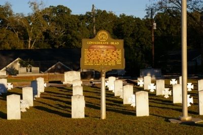
Photographed by David Seibert, October 30, 2010
2. Confederate Dead Marker
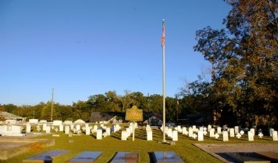
Photographed by David Seibert, October 30, 2010
3. Confederate Dead Marker and Cemetery
Credits. This page was last revised on June 16, 2016. It was originally submitted on November 1, 2010, by David Seibert of Sandy Springs, Georgia. This page has been viewed 1,873 times since then and 44 times this year. Photos: 1, 2, 3. submitted on November 1, 2010, by David Seibert of Sandy Springs, Georgia. • Craig Swain was the editor who published this page.
