Near Baraboo in Sauk County, Wisconsin — The American Midwest (Great Lakes)
Early History of Devil's Lake
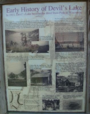
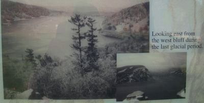
Devil's Lake was created when the last glacier to visit this area began to retreat approximately 14,000 years ago. Glacial debris plugged both ends of the Devil's Lake Gorge as the ice melted. An ancient river that once flowed through the gorge was diverted away by these glacial plugs called terminal moraines. A lake was left behind as a gift from the glacier!
The first inhabitants of the Devil's Lake Area would arrive as the glacier began its final retreat. Native Americans would live here for 500 generations before the first recorded white person, John T. de La Ronde, would arrive in 1832.
They believed that a good spirit, or Manitou, dwelled in the depths of the lake. In their language, they called the lake "Spirit Lake" or "Sacred Lake."
After de La Ronde's visit, settlers would soon be drawn to this mystical lake as stories were told of the magnificent purple bluffs that rose 500 feet above the water. These settlers of European descent would bring with them the customs they knew of land ownership and fencing the land.
Settlers also brought with them superstitions about spirits that dwelled in nature.
Unexplained noises that would echo off of the bluffs added to the mystical aura of the gorge.
Thinking in terms of evil spirits, they would soon corrupt the name "Spirit Lake" to "Devil's Lake."
Caption for upper right photo on marker: Between 700 and 1100 AD, earthen mounds in the shapes of animals were constructed near the lake by a Middle-Woodland culture of Native American called Effigy Mound Builders. The mounds exist to this day.
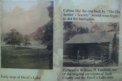
Caption for map at bottom right on marker: Early map of Devil's Lake.
Topics. This historical marker is listed in these topic lists: Environment • Native Americans • Settlements & Settlers. A significant historical year for this entry is 1911.
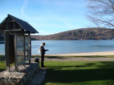
Location. 43° 24.549′ N, 89° 43.62′ W. Marker is near Baraboo, Wisconsin, in Sauk County. Marker can be reached from South Lake Road, 3 miles west of Wisconsin Highway 113, on the right when traveling west. The marker is in the South Shore area of Devil's Lake State Park (an entrance fee is required). Touch for map. Marker is in this post office area: Baraboo WI 53913, United States of America. Touch for directions.
Other nearby markers. At least 8 other markers are within walking distance of this marker. North Shore Hotel Era (here, next to this marker); Devil's Lake and the Local Residents (here, next to this marker); South Shore Hotel Era (here, next to this marker); Ice Age National Scientific Reserve (about 400 feet away, measured in a direct line); Camp Life
(approx. 0.8 miles away); Building a Nation (approx. 0.8 miles away); Building a Park System (approx. 0.8 miles away); Hard at Work (approx. 0.8 miles away). Touch for a list and map of all markers in Baraboo.
Photographed By William J. Toman, November 6, 2010
3. Early History of Devil's Lake Marker
Captions for center photo on marker: Cabins like the one built by "The Old Settler's Society" would soon begin to dot the landscape.
Pictured is William H. Canfield one of the original surveyors of Sauk County and the Devil's Lake area.
Pictured is William H. Canfield one of the original surveyors of Sauk County and the Devil's Lake area.
Photographed By William J. Toman, November 6, 2010
4. Early History of Devil's Lake Marker
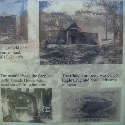
Caption for middle right photo on marker: Designed and built in 1857 by Louis J. Claude, who came here from England, this Tudor Style House was one of the first dwellings built at Devil's Lake. The Claude House was a landmark on the northwest shore of the lake until 1953, when it was removed by the State.
Caption for bottom middle photo on marker: The mantle above the fireplace in the Claude House was hand-carved from butternut.
Caption for bottom right photo on marker: The Claude property was called Eagle Crag and boasted its own vinyard.
Caption for bottom middle photo on marker: The mantle above the fireplace in the Claude House was hand-carved from butternut.
Caption for bottom right photo on marker: The Claude property was called Eagle Crag and boasted its own vinyard.
Credits. This page was last revised on June 16, 2016. It was originally submitted on November 6, 2010, by William J. Toman of Green Lake, Wisconsin. This page has been viewed 1,684 times since then and 124 times this year. Photos: 1. submitted on November 6, 2010, by William J. Toman of Green Lake, Wisconsin. 2, 3, 4, 5. submitted on November 7, 2010, by William J. Toman of Green Lake, Wisconsin. • Bill Pfingsten was the editor who published this page.
