Portland in Northampton County, Pennsylvania — The American Northeast (Mid-Atlantic)
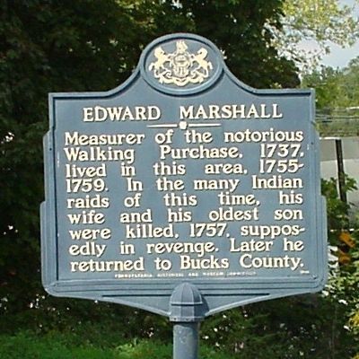
Edward Marshall
Photographed by Trinket Troy, September 22, 2005
1. Edward Marshall Marker
Erected 1948 by Pennsylvania Historical and Museum Commission.
Topics and series. This historical marker is listed in these topic lists: Colonial Era • Indigenous Peoples and Communities • Settlements & Settlers. In addition, it is included in the Pennsylvania Historical and Museum Commission (PHMC) series list. A significant historical year for this entry is 1737.
Location. 40° 55.269′ N, 75° 5.747′ W. Marker is in Portland, Pennsylvania, in Northampton County. It is at the intersection of Delaware Drive (Pennsylvania Route 611) and Hester Street, on the left when traveling north on Delaware Drive. Touch for map. Marker is in this post office area: Mount Bethel PA 18343, United States of America. Touch for directions.

Regionally, this marker is in Southeast Pennsylvania and in Lehigh Valley. It is also in the American Northeast and in the Mid-Atlantic. Globally, it is in North
this page online
Other nearby markers. At least 8 other markers are within 5 miles of this marker, measured as the crow flies: Slateford (approx. one mile away); Delaware, Lackawanna and Western Railroad (approx. 1.1 miles away in New Jersey); Delaware Village Historic District (approx. 2.8 miles away in New Jersey); Christopher Columbus Memorial Highway (approx. 3 miles away in New Jersey); Delaware Water Gap (approx. 3½ miles away); Kittatinny Point (approx. 3.8 miles away in New Jersey); a different marker also named Delaware Water Gap (approx. 4½ miles away); Waring Drive (approx. 4.9 miles away).
Additional commentary.
1.
"Edward Marshall, who
accomplished the great Indian Walk, by which
the Indians were cheated out of a vast hunting-
ground, lived, at this time, at or near the present
village of Slateford."
From the book, "Reminiscences of George La Bar, the centenarian of Monroe County, Pa., who is still living in his 107th
Photographed by Trinket Troy, September 22, 2005
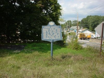
2. Edward Marshall Marker
Taken from Hester Street. Route 611 is in the distance.
— Submitted July 29, 2011, by Mf of Slateford, Pennsylvania.
Credits. This page was last revised on December 9, 2019. It was originally submitted on November 13, 2005, by J. J. Prats of Powell, Ohio. This page has been viewed 3,882 times since then and 71 times this year. Last updated on November 14, 2010, by Timothy Carr of Birmingham, Alabama. Photos: 1, 2. submitted on November 13, 2005.
