Demopolis in Marengo County, Alabama — The American South (East South Central)
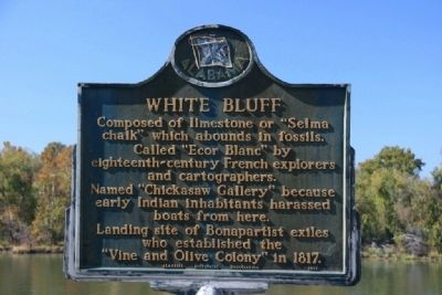
White Bluff
Called “Ecor Blanc” by eighteenth-century French explorers and cartographers.
Named “Chickasaw Gallery” because early Indian inhabitants harassed boats from here.
Landing site of Bonapartist exiles who established the “Vine and Olive Colony” in 1817.
Erected 1971 by Alabama Historical Association.
Topics and series. This historical marker is listed in these topic lists: Native Americans • Natural Features. In addition, it is included in the Alabama Historical Association series list. A significant historical year for this entry is 1817.
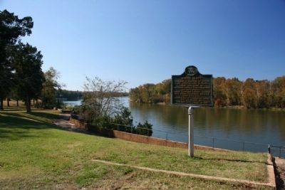
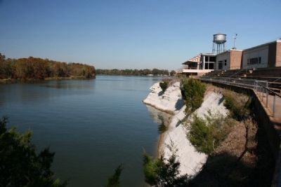
Location. 32° 31.221′ N, 87° 50.453′ W. Marker is in Demopolis, Alabama, in Marengo County. Marker is on West Monroe Street. Marker is located on the banks of the Tombigbee River behind Bluff Hall and next to The Demopolis Civic Center. Touch for map. Marker is at or near this postal address: 407 North Commissioners Avenue, Demopolis AL 36732, United States of America. Touch for directions.
Other nearby markers. At least 8 other markers are within walking distance of this marker. Bluff Hall (within shouting distance of this marker); Trinity Episcopal Church (about 700 feet away, measured in a direct line); Temple B’Nai Jeshurun (about 700 feet away); Marengo County Confederate Monument (approx. 0.2 miles away); The Demopolis Opera House / Lillian Hellman And (approx. ¼ mile away); Alabama Cattlemen’s Association (approx. ¼ mile away); First Presbyterian Church (approx. 0.3 miles away); The Demopolis Theater District (approx. 0.3 miles away). Touch for a list and map of all markers in Demopolis.
Credits. This page was last revised on June 16, 2016. It was originally submitted on November 15, 2010, by Timothy Carr of Birmingham, Alabama. This page has been viewed 1,192 times since then and 30 times this year. Photos: 1, 2, 3, 4. submitted on November 15, 2010, by Timothy Carr of Birmingham, Alabama. • Bill Pfingsten was the editor who published this page.


