Demopolis in Marengo County, Alabama — The American South (East South Central)
Gaineswood
Photographed by Tim & Renda Carr, November 12, 2010
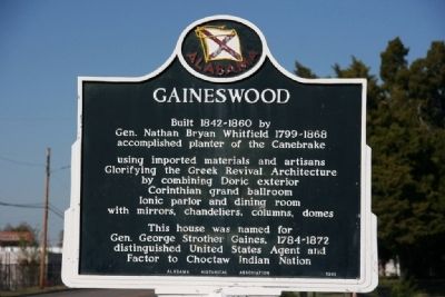
1. Gaineswood Marker
Built 1842-1860 by Gen. Nathan Bryan Whitfield 1799-1868 accomplished planter of the Canebrake
using imported materials and artisans Glorifying the Greek Revival Architecture by combining Doric exterior Corinthian grand ballroom Ionic parlor and dining room with mirrors, chandeliers, columns, domes
This house was named for Gen. George Strother Gaines, 1784-1872 distinguished United States Agent and Factor to Choctaw Indian Nation
Erected 1961 by Alabama Historical Association.
Topics and series. This historical marker is listed in these topic lists: Agriculture • Architecture • Indigenous Peoples and Communities. In addition, it is included in the Alabama Historical Association, and the National Historic Landmarks series lists. A significant historical year for this entry is 1842.
Location. 32° 30.513′ N, 87° 50.11′ W. Marker is in Demopolis, Alabama, in Marengo County. It is at the intersection of South Cedar Avenue and East Whitfield Street, on the right when traveling north on South Cedar Avenue. Touch for map. Marker is at or near this postal address: 805 South Cedar Avenue, Demopolis AL 36732,
this page online

Regionally, this marker is in the American South, specifically in the Deep South, and in the Black Belt. Globally, it is in North America, a Gulf of Mexico state, the Western Hemisphere, the Western World, and the Anglosphere. Historically, it finds itself in what was once New Spain, the territory of the Mississippian Culture, one of the Confederate States of America, and the Antebellum South.
Other nearby markers. At least 8 other markers are within walking distance of this marker: Whitfield Canal (approx. 0.2 miles away); Demopolis Methodist Church (approx. 0.4 miles away); St. Leo’s Catholic Church (approx. 0.4 miles away); "Maison Marengo" (approx. 0.4 miles away); U.S. Jones High School (approx. 0.4 miles away); Downtown Demopolis / Demopolis (approx. 0.6 miles away); The Demopolis Theater District (approx. 0.6 miles away); Alabama Cattlemen’s Association (approx. 0.6 miles away). Touch for a list and map of all markers in Demopolis.
Photographed by Tim & Renda Carr, November 12, 2010
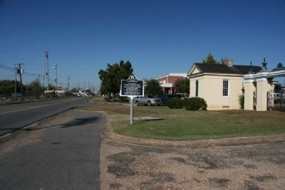
2. Gaineswood Marker In Front Of The Original Gated Entrance
Photographed by Tim & Renda Carr, November 12, 2010
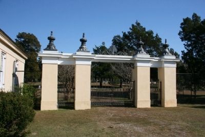
3. The Original Gated Entrance To Gaineswood
Photographed by Tim & Renda Carr, November 12, 2010
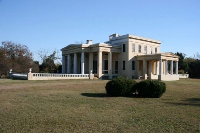
4. Gaineswood (North and West Side)
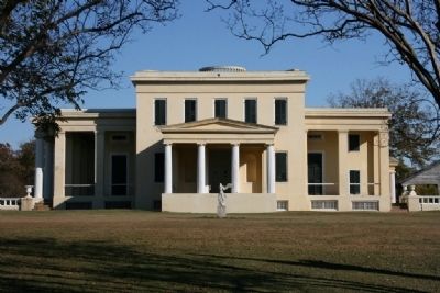
Photographed by Tim & Renda Carr, November 12, 2010
5. Gaineswood (Front or West Side)
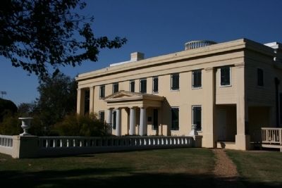
Photographed by Tim & Renda Carr, November 12, 2010
6. Gaineswood (South Side)
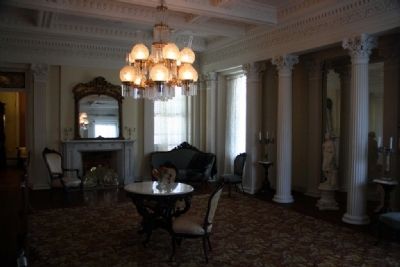
Photographed by Tim & Renda Carr, November 12, 2010
7. Gaineswood's Grand Ballroom
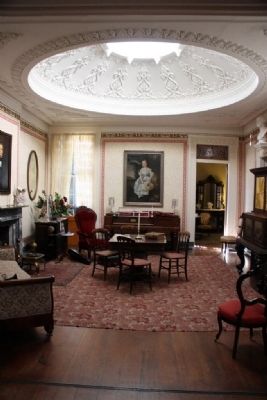
Photographed by Tim & Renda Carr, November 12, 2010
8. Parlor Room at Gaineswood
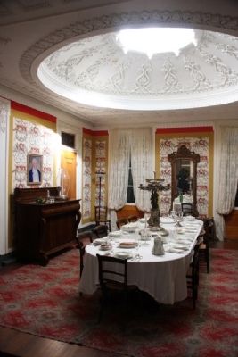
Photographed by Tim & Renda Carr, November 12, 2010
9. Dining Room at Gaineswood
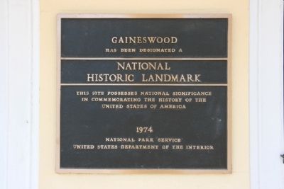
Photographed by Tim & Renda Carr, November 12, 2010
10. National Historic Landmark
Credits. This page was last revised on July 16, 2025. It was originally submitted on November 16, 2010, by Timothy Carr of Birmingham, Alabama. This page has been viewed 2,085 times since then and 32 times this year. Photos: 1, 2, 3, 4, 5, 6, 7, 8, 9, 10. submitted on November 16, 2010, by Timothy Carr of Birmingham, Alabama. • Bill Pfingsten was the editor who published this page.
