Dover in Stewart County, Tennessee — The American South (East South Central)
Foote's Gunboat Flotilla
Fort Donelson National Battlefield Park
— National Park Service, U.S. Department of the Interior —
Inscription.
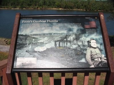
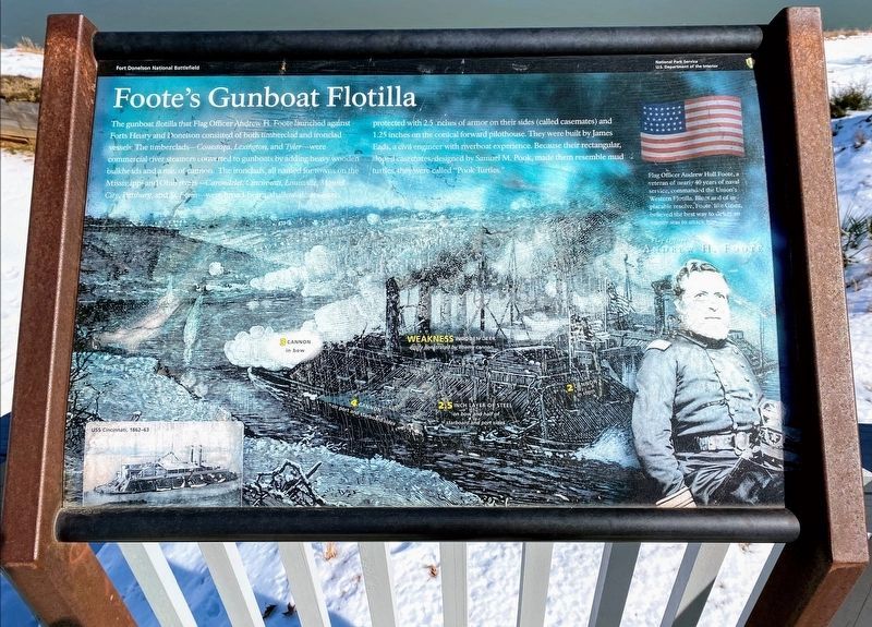
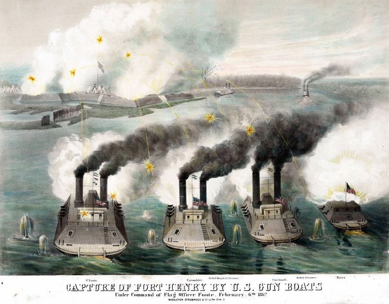
The gunboat flotilla that Flag Officer Andrew H. Foote launched against Forts Henry and Donelson consisted of both timberclad and ironclad vessels. The timberclads - Conestoga, Lexington, and Tyler - were commercial river steamers converted to gunboats by adding heavy wooden bulkheads and a mix of cannon. The ironclads, all named for towns on the Mississippi and Ohio rivers - Carondelet, Cincinnati, Louisville, Mound City, Pittsburg, and St. Louis - were broad-beam, shallow-draft vessels protected with 2.5 inches of armor on their sides (called casemates) and 1.25 inches on the conical forward pilothouse. They were built by James Eads, a civil engineer with riverboat experience. Because of their rectangular sloped casemates, designed by by Samuel M. Pook, made them resemble mud turtles, they were called "Pook Turtles."
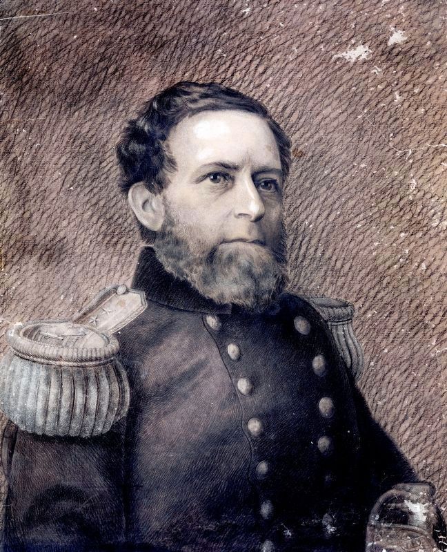
Flag Officer Andrew H. Foote
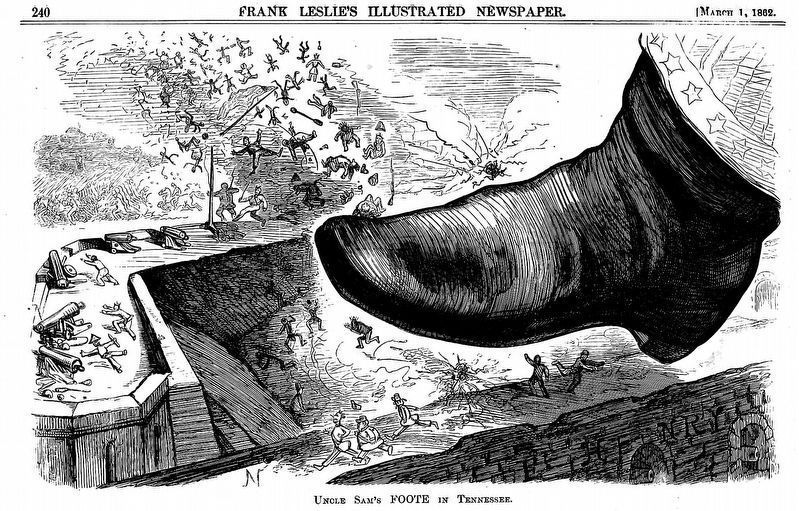
Flag officer Andrew Hull Foote, a veteran of nearly 40 years of naval service, commanded the Union's Western Flotilla. Blunt and of implacable resolve, Foote, like Grant, believed the best way to defeat an enemy was to attack him.
Erected by National Park Service, U.S. Department of the Interior.
Topics. This historical marker is listed in these topic lists: Forts and Castles • War, US Civil • Waterways & Vessels.
Location. 36° 29.688′ N, 87° 51.37′ W. Marker is in Dover, Tennessee, in Stewart County. Marker is on Lock D Loop, 0.9 miles north of Eddyville Spur Road, on the right when traveling north. Located at stop 4, the river batteries, on the driving tour of Fort Donelson National Battlefield. Touch for map. Marker is in this post office area: Dover TN 37058, United States of America. Touch for directions.
Other nearby markers. At least 8 other markers are within walking distance of this marker. Exchanging Iron Valentines (here, next to this marker); Control the Rivers and Railroads (here, next to this marker); Reconstructed Powder Magazine (here, next to this marker); See Me Take a Chimney! (a few steps from this marker); The River Batteries (a few steps from this marker); Gun Positions (within shouting distance of this marker); Killed By a Loose Bolt (within shouting distance of this marker); U.S. Gunboat Carondelet (within shouting distance of this marker). Touch for a list and map of all markers in Dover.
Also see . . . Fort Donelson. National Park Service site. (Submitted on November 23, 2010, by Craig Swain of Leesburg, Virginia.)
Library of Congress
6. Capture of Fort Henry by U.S. Gun Boats under the Command of Flag Officer Foote, February 6th 1862
“Print shows four Union ironclads in the foreground, identified as the ‘St. Louis’, ‘Carondelet’, ‘Cincinnati’, and the ‘Essex’, bombarding Confederate Fort Henry in the background; also shows two Confederate steamboats, one identified as a ‘Rebel Hospital Steamer’” --LOC.
lithograph by Middleton, Strobridge & Co.
lithograph by Middleton, Strobridge & Co.
Credits. This page was last revised on May 10, 2021. It was originally submitted on November 23, 2010, by Craig Swain of Leesburg, Virginia. This page has been viewed 990 times since then and 33 times this year. Photos: 1. submitted on November 23, 2010, by Craig Swain of Leesburg, Virginia. 2. submitted on May 10, 2021, by Shane Oliver of Richmond, Virginia. 3. submitted on November 23, 2010, by Craig Swain of Leesburg, Virginia. 4. submitted on May 10, 2021, by Shane Oliver of Richmond, Virginia. 5, 6, 7. submitted on January 11, 2021, by Allen C. Browne of Silver Spring, Maryland.
