Lower Garden District in New Orleans in Orleans Parish, Louisiana — The American South (West South Central)
Margaret's Place and Walk / Lower Garden District
Inscription.
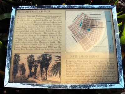
Margaretís Place and Walk
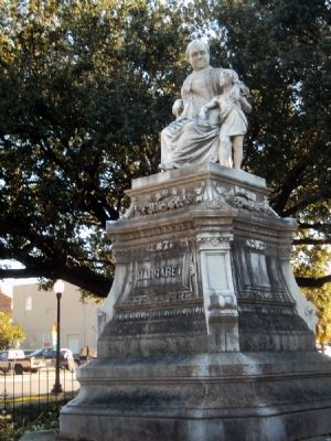
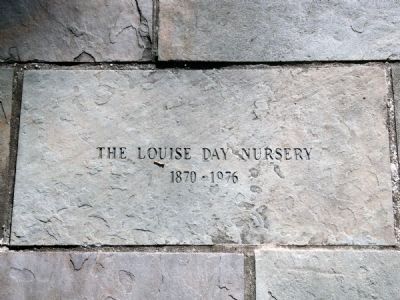
Margaretís Place and Walk honors Irish Immigrant Margaret Gaffney Haughery (1813-1882), who devoted her life to orphaned children and the needy. An orphan herself, Margaret lost her husband and baby to illness. Although illiterate, Margaret established a dairy and a bakery and became quite wealthy. Her wealth funded seven orphanages which she established with her friend, Sister Regis and the Daughters of Charity. The names of the orphanages are shown in the pavement leading to her statue, sculpted by Alexander Doyle of New York in 1884. The funds for the statue were raised by public subscription after Margaretís death. The statue was located within sight of the New Orleans Female Orphan Asylum (demolished 1965) and the Louise Day Nursery, which she helped to found.
Lower Garden District
Margaretís Place leads the visitor into the Lower Garden District, now a National Historic District. In 1806-1807, city surveyor Barthelemy Lafon laid out the neighborhood upon the lands of the Delord-Sarpy plantation and the boundaries of the faubourgs LaCourse and Annunciation. Lafonís classical plan featured a series of parks with basins, fountains and tree-lined streets, some of which bear the names of the nine Muses of Greek mythology.
Topics. This historical marker is listed in these topic lists: Charity & Public Work • Roads & Vehicles • Settlements & Settlers • Women. A significant historical year for this entry is 1884.
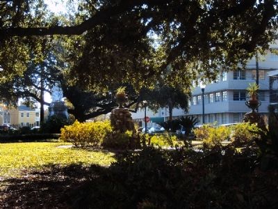
Location. 29° 56.442′ N, 90° 4.33′ W. Marker is in New Orleans, Louisiana, in Orleans Parish. It is in the Lower Garden District. Marker is at the intersection of Prytania Street and Clio St., on the left when traveling south on Prytania Street. The marker and the statue it describes sit in a small park next to the Ponchartrain Expressway. The park is bounded by Prytania Street, Clio Street, Margaret Place and Coliseum Street and Camp Street. Touch for map. Marker is at or near this postal address: 1133 Prytania Street, New Orleans LA 70130, United States of America. Touch for directions.
Other nearby markers. At least 8 other markers are within walking distance of this marker. Saint Theresa of Avila Church (about 400 feet away, measured in a direct line); The Beginning (approx. 0.2 miles away); Atlantic Wall Fragments (approx. 0.2 miles away); 8 in. Columbaid Cannon (approx. 0.2 miles away); Julia Row (approx. 0.3 miles away); Starting Point of the First Traditional New Orleans Mardi Gras Parade (approx. 0.4 miles
away); Byrd Residence (approx. 0.4 miles away); The 747 (approx. 0.4 miles away). Touch for a list and map of all markers in New Orleans.
More about this marker. The marker sits at the foot of a short walk that leads up to the front of the statue.
Also see . . . The Birthplace of Margaret Haughery, of New Orleans. Some interesting history on Margaret's early life in Ireland. (Submitted on December 2, 2010, by Jamie Abel of Westerville, Ohio.)
Credits. This page was last revised on February 12, 2023. It was originally submitted on December 2, 2010, by Jamie Abel of Westerville, Ohio. This page has been viewed 1,440 times since then and 56 times this year. Photos: 1, 2, 3, 4, 5. submitted on December 2, 2010, by Jamie Abel of Westerville, Ohio. • Bill Pfingsten was the editor who published this page.


