
Marion Township near Womelsdorf in Berks County, Pennsylvania — The American Northeast (Mid-Atlantic)
Livingood (Löwengut) Family
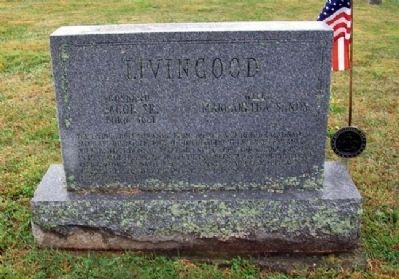
Photographed by William Fischer, Jr., September 12, 2010
1. Livingood (Löwengut) Family Marker
The Livingood family came from Switzerland to the Palatinate. Jacob and his father, John Wendell Leibengut embarked for America with the first party of Palatines, May 6, 1709 from London, England. In 1728 Jacob Sr. arrived in the Tulpehocken Valley with the second exodus from Schoharie, New York. Jacob Sr. and Margaretha were killed and scalped by the Indians near Mount Aetna, Berks County, Pa, April [8] 1758.
Jacob Sr., born 1681
Margaretha Sands [his] wife
Jacob Jr., died 1788
Catherine Durr, died 1791
In Holy Matrimony, October 2, 1750
Jacob III, born January 26, 1752
ARW Captain - Continental Army 1781-82
Erected 1985 by the Rev. John G. and Alverta Levengood Family and Friends.
Topics. This historical marker is listed in these topic lists: Colonial Era • Settlements & Settlers • Wars, US Indian. A significant historical date for this entry is January 26, 1752.
Location. 40° 22.939′ N, 76° 14.831′ W. Marker is near Womelsdorf, Pennsylvania, in Berks County. It is in Marion Township. It can be reached from Longs Church Ln. Marker is in the Christ Evangelical Lutheran Church Cemetery, about 0.1 miles SSE of the
this page online

Regionally, this marker is in Southeast Pennsylvania and specifically in Pennsylvania Dutch Country. It is also in the American Northeast and in the Mid-Atlantic. Globally, it is in North America, the Western Hemisphere, the Western World, and the Anglosphere. Historically, it finds itself in what was once the Haudenosaunee (Iroquois) Confederacy and also one of the original Thirteen Colonies.
Other nearby markers. At least 8 other markers are within 4 miles of this marker, measured as the crow flies: Regina Leininger (a few steps from this marker); John A. Shulze (about 600 feet away, measured in a direct line); Caspar Wistar (approx. 0.8 miles away); Marion Township Veterans Memorial (approx. 0.9 miles away); Tulpehocken Evangelical and Reformed Church (approx. one mile away); Fort Zeller (approx. 2.9 miles away); Myerstown (approx. 3 miles away); William L. Derr Community Swimming Pool (approx. 3.1 miles
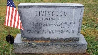
Photographed by William Fischer, Jr., September 12, 2010
2. Livingood (Löwengut) Family Marker (back)
Also see . . . Jacob Livingood Genealogy. (Submitted on December 25, 2010, by William Fischer, Jr. of Reynoldsburg, Ohio.)
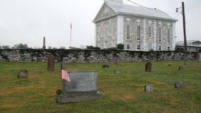
Photographed by William Fischer, Jr., September 12, 2010
3. Livingood (Löwengut) Family Marker
Looking SSE, with Christ Evangelical Lutheran Church in background
Credits. This page was last revised on February 7, 2023. It was originally submitted on December 25, 2010, by William Fischer, Jr. of Reynoldsburg, Ohio. This page has been viewed 1,591 times since then and 26 times this year. Photos: 1, 2, 3. submitted on December 25, 2010, by William Fischer, Jr. of Reynoldsburg, Ohio.
