Near Kingston, Ontario — Central Canada (North America)
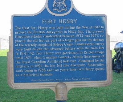
Fort Henry
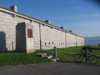
The first Fort Henry was built during the War of 1812 to protect the British dockyards in Navy Bay. The present limestone citadel, constructed between 1832 and 1837, replaced the old fort as part of a larger plan for the defence of the recently completed Rideau Canal. Commissariat stores were built to join the advanced battery with the main fort in 1841-42. Fort Henry was garrisoned by British troops until 1871, when Canadian Gunnery Schools (forerunner of the Royal Canadian Artillery) took over. Abandoned by the military in 1891, the fort fell into disrepair. Restoration work began in 1936, and two years later Fort Henry opened as a historical museum.
Topics and series. This historical marker is listed in these topic lists: Forts and Castles • War of 1812 • Waterways & Vessels. In addition, it is included in the Canada, Ontario Heritage Foundation series list. A significant historical year for this entry is 1812.
Location. 44° 13.832′ N, 76° 27.618′ W. Marker is near Kingston, Ontario. Marker can be reached from Provincial Highway 2. Marker is located at the Fort Henry National Historic Site of Canada. Touch for map. Marker is in this post office area: Kingston ON K7K 5G8, Canada. Touch for directions.
Other nearby markers. At least 8 other markers are within walking distance of this marker. A different marker also named Fort Henry (within shouting distance of this marker); Kingston Navy Yard (approx. half a kilometer away); The Stone Frigate (approx. half a kilometer away); Strategic Importance / Importance Stratégique (approx. 0.6 kilometers away); Point Frederick Buildings (approx. 0.7 kilometers away); Sir James Lucas Yeo (approx. 0.7 kilometers away); Commodore’s Residence, 1815 (approx. 0.7 kilometers away); Pro Patria 1812-1814 (approx. 0.8 kilometers away). Touch for a list and map of all markers in Kingston.
More about this marker. Kingston is independent from the surrounding Frontenac County.
Credits. This page was last revised on March 27, 2024. It was originally submitted on December 31, 2010, by Bob (peach) Weber of Dewey, Arizona. This page has been viewed 1,189 times since then and 14 times this year. Photos: 1, 2, 3, 4, 5, 6. submitted on December 31, 2010, by Bob (peach) Weber of Dewey, Arizona. • Syd Whittle was the editor who published this page.
Editor’s want-list for this marker. Wide area photo of the marker and its surroundings. • Can you help?
