Captive Tourists
The Nez Perce Encounter
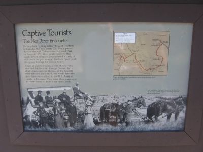
During their fighting retreat toward freedom in Canada, the non-treaty Nez Perce passed directly through Yellowstone National Park in August, 1877. Their route followed this creek. When outriders encountered a party of sightseers camped nearby, the Nez Perce held the group hostage for several hours.
Angry at past betrayals, a pair of Nez Perce shot and left for dead George Cowan, but a chief intervened and the rest of the tourists were released unharmed. Six weeks later the Nez Perce surrendered to the U.S. Army in northern Montana. They were then transferred to reservations far from their home lands.
Photo caption: Mr. and Mrs. George Cowan are believed to be the two middle figures standing in front of the stagecoach.
Topics and series. This historical marker is listed in this topic list: Native Americans. In addition, it is included in the The Nez Perce Trail series list. A significant historical year for this entry is 1877.
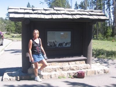
Location. This marker has been replaced by another marker nearby. 44° 34.44′ N, 110° 49.375′ W. Marker is in Yellowstone National Park, Wyoming, in Park County. It is in Mammoth. Marker is on Grand Loop Road (U.S. 20) 0.4 miles east of Fountain Flat Drive, on the right when traveling south. Touch for map. Marker
Other nearby markers. At least 8 other markers are within 3 miles of this location, measured as the crow flies. Chance Encounter (here, next to this marker); Nez Perce War (a few steps from this marker); a different marker also named Chance Encounter (a few steps from this marker); Murky Past . . . Promising Future (approx. ¾ mile away); Earthquake’s Offspring (approx. 1.8 miles away); Fountain Paint Pot (approx. 1.8 miles away); a different marker also named Fountain Paint Pot (approx. 1.8 miles away); White Dome Geyser (approx. 2.6 miles away). Touch for a list and map of all markers in Yellowstone National Park.
Regarding Captive Tourists. This marker was replaced by a new one named Chance Encounter (see nearby markers).
Also see . . . Nez Perce War - Wikipedia. (Submitted on January 6, 2011, by Bill Pfingsten of Bel Air, Maryland.)
Credits. This page was last revised on February 16, 2023. It was originally submitted on January 4, 2011, by Bob (peach) Weber of Dewey, Arizona. This page has been viewed 820 times since then and 24 times this year. Photos: 1, 2. submitted on January 4, 2011, by Bob (peach) Weber of Dewey, Arizona. • Bill Pfingsten was the editor who published this page.

