Near Moscow in Hancock County, West Virginia — The American South (Appalachia)
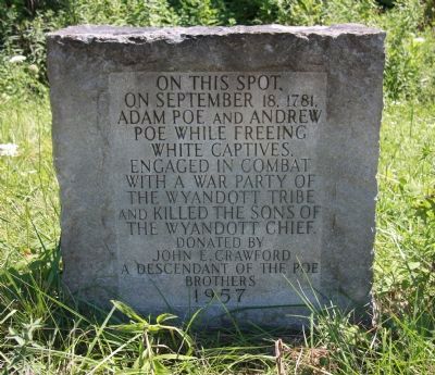
On This Spot
Photographed by Dale K. Benington, July 26, 2010
1. On This Spot Marker
Erected 1957 by donated by John E. Crawford, a descendant of the Poe Brothers.
Topics. This historical marker is listed in these topic lists: Indigenous Peoples and Communities • War, US Revolutionary • Wars, US Indian. A significant historical month for this entry is September 1904.
Location. 40° 32.756′ N, 80° 37.746′ W. Marker is near Moscow, West Virginia, in Hancock County. It is at the intersection of West Virginia Route 2 and Ferndale Road (County Route 66/2), on the right when traveling north on West Virginia Route 2. Touch for map. Marker is in this post office area: New Cumberland WV 26047, United States of America. Touch for directions.

Regionally, this marker is in the Northern Panhandle and in the High Valley. It is also in the American South, specifically in the Upper South, in the Ohio River Valley, and in Appalachia. Globally, it is in North America, the Western Hemisphere, the Western World, and the Anglosphere.
this page online
Other nearby markers. At least 8 other markers are within 3 miles of this marker, measured as the crow flies: Early Mills (a few steps from this marker); Village of Stratton Veterans Memorial Park (approx. 1.6 miles away in Ohio); Lest We Forget - Chief Logan (approx. 2½ miles away in Ohio); Ohio Buckeye Tree (approx. 2½ miles away in Ohio); World Wars I & II Memorial (approx. 2½ miles away in Ohio); Empire (approx. 2.6 miles away in Ohio); New Manchester Veterans Memorial (approx. 2.7 miles away); Bicentennial Park (approx. 2.7 miles away).
Photographed by Dale K. Benington, July 26, 2010
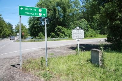
2. On This Spot Marker
View of historical monument situated next to state historical marker.
Photographed by Dale K. Benington, July 26, 2010
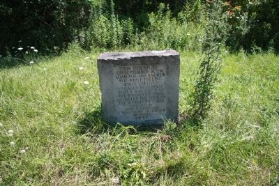
3. On This Spot Marker
Credits. This page was last revised on September 4, 2020. It was originally submitted on January 11, 2011, by Dale K. Benington of Toledo, Ohio. This page has been viewed 1,684 times since then and 54 times this year. Photos: 1, 2, 3. submitted on January 11, 2011, by Dale K. Benington of Toledo, Ohio.
