Broad Creek Hundred near Laurel in Sussex County, Delaware — The American Northeast (Mid-Atlantic)
Nathaniel Mitchell
(1752-1813)

Photographed by Nate Davidson, January 17, 2011
1. Nathaniel Mitchell Marker
Mitchell is buried on the grounds of the historic Old Christ Church of Laurel.
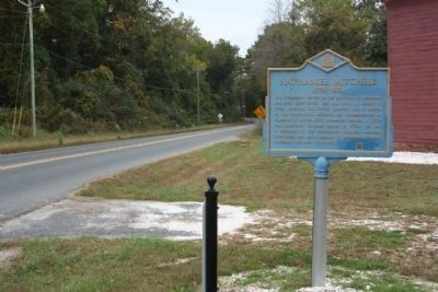
This Federalist served as the governor of Delaware between 1805-1808. He was born in Laurel in 1752, attended Old Christ Church, and is buried in this churchyard. Mitchell was commissioned as adjutant of militia 1775, promoted captain in 1776, and appointed brigade major in 1779. He was a delegate to the Continental Congress between 1786-1788 and was a member of Delaware's General Assembly between 1808-1812.
Erected by Delaware Public Archives. (Marker Number S-68.)
Topics and series. This historical marker is listed in these topic lists: Cemeteries & Burial Sites • Colonial Era • Patriots & Patriotism • War, US Revolutionary. In addition, it is included in the Daughters of the American Revolution (DAR), and the Delaware Public Archives series lists. A significant historical year for this entry is 1752.
Location. 38° 33.65′ N, 75° 32.233′ W. Marker is near Laurel, Delaware, in Sussex County. It is in Broad Creek Hundred. It is at the intersection of Chipmans Pond Road (County Road 465) and Christ Church Roads (County Road 465A) on Chipmans Pond Road. Touch for map. Marker is at or near this postal
this page online

Regionally, this marker is in the American Mid-Atlantic, on the Delmarva Peninsula, and on the Eastern Seaboard. Globally, it is in the North Atlantic Region, North America, the Western Hemisphere, the Western World, and the Anglosphere. Historically, it finds itself in what was once New Netherland, one of the original Thirteen Colonies, and the Antebellum South.
Other nearby markers. At least 8 other markers are within 2 miles of this marker, measured as the crow flies: A different marker also named Nathaniel Mitchell (within shouting distance of this marker); Old Christ Church (within shouting distance of this marker); Veterans Memorial (approx. 0.4 miles away); 407 5th Street (approx. 1.7 miles away); Shepard House (approx. 1.7 miles away); 511 Pine Street (approx. 1.7 miles away); Wooten-Truitt House (approx. 1.7 miles away); Gordy-Windsor House (approx. 1.7 miles away). Touch for a list and map of all markers in Laurel.
Also see . . . Nathaniel Mitchell - A Biographical Directory of the United States Congress.
Photographed by Mike Stroud, October 15, 2012
2. Nathaniel Mitchell Marker, northwest along Chipman's Pond Road
New QR Code attached in Lower right corner.
Quick Response Code for quick reading on modern cell phones and devices

Photographed by Mike Stroud, October 15, 2012
3. Nathaniel Mitchell Marker at intersection of Chipman's Pond Road and Christ Church Road

Photographed by Nate Davidson, January 17, 2011
4. Nathaniel Mitchell Gravesite Marker
1753-1813
First native son of Laurel
to be
Governor of Delaware
1805-1808
Hero of the Revolution
1775-1781
Member
Continental Congress
1786-1788.
Erected by
Laurel Historical Society, Inc.
July 4, 1978.

Photographed by Nate Davidson, January 17, 2011
5. Nathaniel Mitchell Gravesite Marker 2
Revolutionary soldier Nathaniel Mitchell, 1775-1781. Placed by Major Nathaniel Mitchell Chapter DAR.
Credits. This page was last revised on October 31, 2026. It was originally submitted on January 17, 2011, by Nathan Davidson of Salisbury, Maryland. This page has been viewed 1,136 times since then and 19 times this year. Photos: 1. submitted on January 17, 2011, by Nathan Davidson of Salisbury, Maryland. 2, 3. submitted on October 23, 2012, by Mike Stroud of Bluffton, South Carolina. 4, 5. submitted on January 17, 2011, by Nathan Davidson of Salisbury, Maryland. • Bill Pfingsten was the editor who published this page.
