Fort George Island near Jacksonville in Duval County, Florida — The American South (South Atlantic)
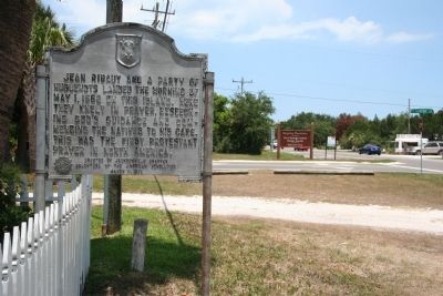
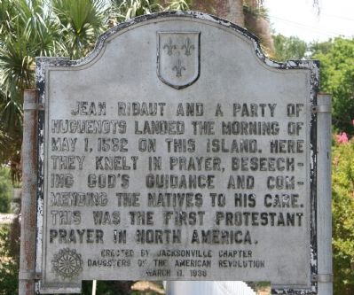
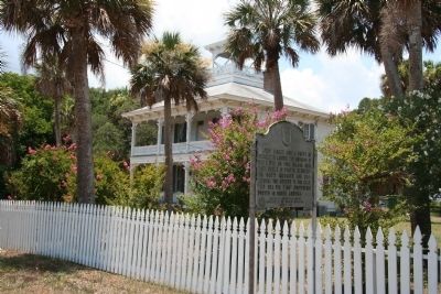
Jean Ribaut
Erected 1936 by the Jacksonville Chapter of the Daughters of the American Revolution.
Topics and series. This historical marker is listed in these topic lists: Colonial Era • Exploration • Native Americans. In addition, it is included in the Daughters of the American Revolution series list. A significant historical date for this entry is May 1, 1562.
Location. 30° 24.148′ N, 81° 25.947′ W. Marker is near Jacksonville, Florida, in Duval County. It is on Fort George Island. Marker is on Heckscher Drive (State Road 1A) south of Fort George Road, on the right when traveling south. Touch for map. Marker is in this post office area: Jacksonville FL 32226, United States of America. Touch for directions.
Other nearby markers. At least 8 other markers are within 2 miles of this marker, measured as the crow flies. Pilot Town/Napoleon Bonaparte Broward (within shouting distance of this marker); U.S. Merchant Marine (approx. half a mile away); French Huguenots in North America (approx. half a mile away); Historic Old Mayport Cemetery (approx. 0.7 miles away); St. George Episcopal Church (approx. 0.8 miles away); The Huguenot Memorial Site (approx. 0.9 miles away); Fort George Island (approx. 1.8 miles away); Ribault Club Inn (approx. 1.8 miles away). Touch for a list and map of all markers in Jacksonville.

Photographed By Dale K. Benington, June 26, 2010
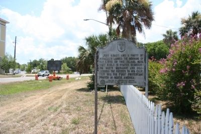
4. Jean Ribaut Marker
View looking north along Heckscher Drive (Florida Route 1A), with the intersection of Fort George Road in the background, of the historical marker. Note the sign for the "Kingsley Plantation, Fort George Island Visitor Center" in the background.
Credits. This page was last revised on February 3, 2023. It was originally submitted on February 2, 2011, by Dale K. Benington of Toledo, Ohio. This page has been viewed 1,226 times since then and 25 times this year. Photos: 1, 2, 3, 4. submitted on February 2, 2011, by Dale K. Benington of Toledo, Ohio.


