
Near Manassas in Prince William County, Virginia — The American South (Mid-Atlantic)
49th Georgia Infantry
Second Battle of Manassas
April 22, 2007
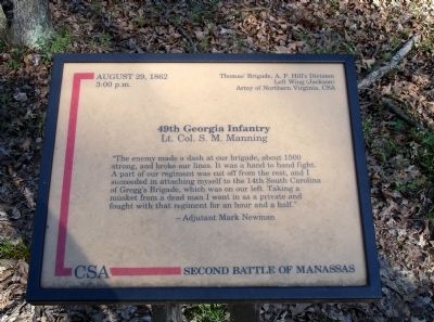
1. 49th Georgia Infantry Marker
3:00 p.m.
Thomas’ Brigade, A.P. Hill’s Division
Left Wing (Jackson)
Army of Northern Virginia, CSA
49th Georgia Infantry
Lt. Col. S. M. Manning
“The enemy made a dash at our brigade, about 1500 strong, and broke our lines. It was a hand to hand fight. A part of our regiment was cut off from the rest, and I succeeded in attaching myself to the 14th South Carolina of Gregg’s Brigade, which was on our left. Taking a musket from a dead man I went in as a private and fought with that regiment for an hour and a half.”
- Adjutant Mark Newman
Topics. This historical marker is listed in this topic list: War, US Civil. A significant historical year for this entry is 1862.
Location. 38° 49.89′ N, 77° 32.515′ W. Marker is near Manassas, Virginia, in Prince William County. It can be reached from Featherbed Lane (County Route 622). Located on the Unfinished Railroad Loop Trail, along the old railroad bed, in Manassas National Battlefield Park. Touch for map. Marker is in this post office area: Manassas VA 20109, United States of America. Touch for directions.

Regionally, this marker is in the Washington Metropolitan
this page online
Other nearby markers. At least 8 other markers are within walking distance of this marker: 1st Massachusetts Infantry (about 400 feet away, measured in a direct line); Second Brigade (about 600 feet away); Gregg’s Brigade (about 800 feet away); Grover’s Attack ▪ Union Bayonet Charge (about 800 feet away); 45th Georgia Infantry (approx. 0.2 miles away); 2nd New Hampshire Infantry (approx. ¼ mile away); 63rd Pennsylvania Infantry (approx. 0.3 miles away); Archer’s Brigade (approx. 0.4 miles away). Touch for a list and map of all markers in Manassas.
Also see . . .
1. 49th Georgia Volunteer Infantry. Information gathered
February 27, 2011
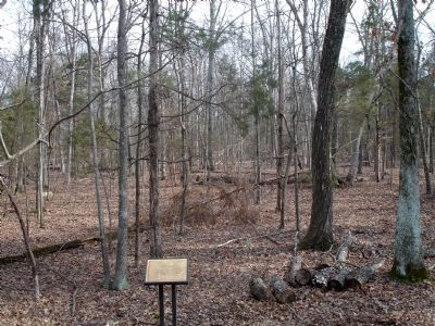
2. 49th Georgia Infantry Marker
2. Second Manassas Battle Report: Thomas's Brigade. (Submitted on February 27, 2011.)
Credits. This page was last revised on April 16, 2017. It was originally submitted on February 27, 2011. This page has been viewed 1,391 times since then and 31 times this year. Photos: 1, 2. submitted on February 27, 2011. • Craig Swain was the editor who published this page.
