Near Fair Haven in Vernon County, Missouri — The American Midwest (Upper Plains)
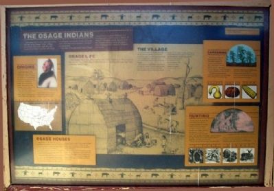
The Osage Indians
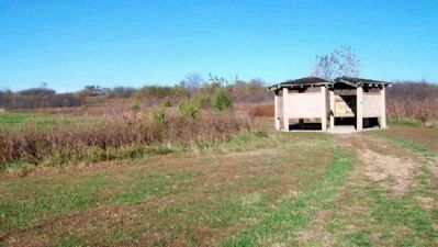
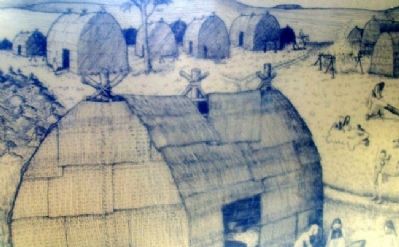
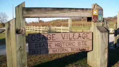
The small hill to your right was once the site of an Osage Indian village. More than 300 years ago, this site would have been covered with large, rectangular homes for a tribe of people who have become a symbol of history on the prairie.
This site is the earliest known Osage village site in western Missouri. It is located within a small area of about 12 miles by 10 miles, where almost all of the Osage sites and early European sites relating to the Osage in Missouri are found.
Origins
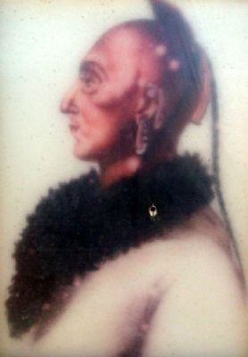
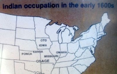
Much of the history of the Osage Indians before the arrival of Europeans remains a mystery. The Osage may have developed from other groups already living in the area or split off from another group such as the Kansa. They spoke the same language as other Indians in the area, including the Kansa, Omaha, and Ponca. Many of the items they made, such as pottery, appear similar to those made by these tribes. When first encountered by Europeans, they had not been living in western Missouri more than 50 years.
Osage Life
The Osage often made their homes near major streams on the margin of the prairie. The Osage way of life centered on hunting, although they also cultivated some crops.
Osage Houses
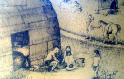
Osage houses were made from poles that were bent and fastened to posts in the ground. The framework was covered with woven mats and hides. Houses were rectangular, measuring 30 to 50 feet long and 15 to 20 feet wide. Doorways were on the long side of the house and always faced east.
House interiors probably appeared cluttered, with mats, skins, and baskets covering much of the floor. Shallow pits in the floor were used for fireplaces while deeper pits were used for storage. Common items in the houses included pottery cooking vessels, wooden serving bowls, shell or bone spoons, and gourds for water containers.
Food and other items that needed to be kept away from the dogs were hung from posts and rafters or in skin bags. Strings of cooked dry corn, water-lily roots, persimmon cakes, and dried squash and pumpkin often were hung from posts.
The Village
Outside the houses, racks were set up for drying meat and vegetables to eat, and for plants to be woven into mats. Some were dried in the sun, while others had small, slow-burning fires below them to hasten the drying process.
Skins of animals were staked on the ground or hung from wooden trusses. Women worked the skins into a usable state or processed them for trading. The first step was to remove the flesh on the inside of the skin by scraping it. If the hide was to be used as a robe, the hair was left attached. If the skin was used for clothing, it was stretched by spreading it over
a log and rubbing it with a bone. It was then softened by pulling it through a small hole in a log.
Gardening
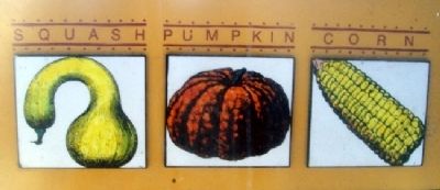
Gardening was done by the women of the village. Corn, beans, squash, and pumpkins were planted in April. Using a bison scapula hoe, the soil was hilled into a mound. A hole was then punched with a digging stick and the seed planted.
The gardens were usually left unattended because most of the village went hunting in the summer. They returned in August so the women could harvest the crops. Squash and pumpkins were peeled, then cut in strips to dry. Corn was stored in all forms - on the cob, kerneled, and ground.
Hunting
Hunting was an important part of the Osage way of life. The hunting cycle began in February or March when they began to hunt bear and beaver. They returned to the village in April to plant gardens. In May, the summer hunt for bison and deer began. They returned to the village in August to harvest the crops. The fall hunt for bison and deer began in September and lasted until December.
Although the men did the hunting, the women were along to butcher the animals, dry the meat, and prepare the skins. They also gathered food, such as persimmons and nuts, as well as medicinal plants.
Erected by Missouri State Parks.
Topics. This historical marker is listed in
this topic list: Native Americans.
Location. 37° 58.878′ N, 94° 12.54′ W. Marker is near Fair Haven, Missouri, in Vernon County. Marker is in the kiosk located about 300 feet northeast of the parking lot at Osage Village State Historic Site, off Road C, about 2 miles west of Fair Haven. Touch for map. Marker is in this post office area: Harwood MO 64750, United States of America. Touch for directions.
Other nearby markers. At least 8 other markers are within 12 miles of this marker, measured as the crow flies. The Osage and the Fur Trade (here, next to this marker); Archaeology (here, next to this marker); Changing Life Styles (here, next to this marker); Encounter With Europeans: The Change Begins (here, next to this marker); Osage Sites in the Area (about 600 feet away, measured in a direct line); Harmony Mission (approx. 11.2 miles away); The Town That Coal Built (approx. 11˝ miles away); Veterans Memorial (approx. 12 miles away). Touch for a list and map of all markers in Fair Haven.
Also see . . .
1. Osage Village State Historic Site. Missouri State Parks website entry (Submitted on March 16, 2011, by William Fischer, Jr. of Scranton, Pennsylvania.)
2. The Osage Nation. Website homepage (Submitted on March 16, 2011, by William Fischer, Jr. of Scranton, Pennsylvania.)
Credits. This page was last revised on May 24, 2022. It was originally submitted on March 16, 2011, by William Fischer, Jr. of Scranton, Pennsylvania. This page has been viewed 2,170 times since then and 67 times this year. Photos: 1, 2, 3, 4, 5, 6, 7, 8. submitted on March 16, 2011, by William Fischer, Jr. of Scranton, Pennsylvania.
