Erie in Erie County, Pennsylvania — The American Northeast (Mid-Atlantic)
Fort Presque Isle
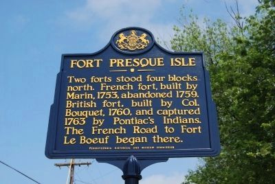
Photographed by Mike Wintermantel, July 2, 2015
1. Fort Presque Isle Marker
Erected 1946 by Pennsylvania Historical and Museum Commission.
Topics and series. This historical marker is listed in these topic lists: Forts and Castles • Indigenous Peoples and Communities • War, French and Indian. In addition, it is included in the Pennsylvania Historical and Museum Commission (PHMC) series list. A significant historical year for this entry is 1753.
Location. 42° 7.964′ N, 80° 4.605′ W. Marker is in Erie, Pennsylvania, in Erie County. It is at the intersection of East 6th Street (Alternate Pennsylvania Route 5) and Parade Street, on the right when traveling west on East 6th Street. Located at the Pennsylvania Army National Guard Armory (1st Battallion, 112th Infantry). Touch for map. Marker is at or near this postal address: 350 East 6th Street, Erie PA 16507, United States of America. Touch for directions.

Regionally, this marker is in Northwestern Pennsylvania. It is
this page online
Other nearby markers. At least 8 other markers are within walking distance of this marker: Pennsylvania National Guard (within shouting distance of this marker); Conrad-Brevellier Houses (about 300 feet away, measured in a direct line); Brewery Lane (about 400 feet away); Judah Colt House (approx. 0.2 miles away); von Buseck House (approx. 0.2 miles away); Anthony Wayne (approx. ¼ mile away); Kennedy Double House (approx. 0.3 miles away); Kennedy Row Houses (approx. 0.3 miles away). Touch for a list and map of all markers in Erie.
Also see . . . Fort Presque Isle - Behind the Marker. Explore PA History website entry (Submitted on March 21, 2011, by Mike Wintermantel of Pittsburgh, Pennsylvania.)
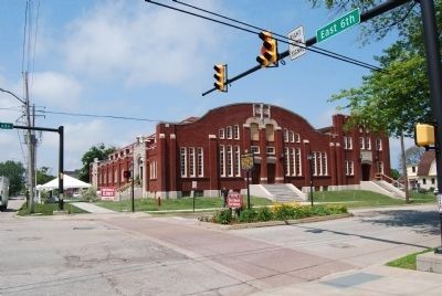
Photographed by Mike Wintermantel, July 2, 2015
2. Fort Presque Isle Marker
Credits. This page was last revised on June 17, 2025. It was originally submitted on March 21, 2011, by Mike Wintermantel of Pittsburgh, Pennsylvania. This page has been viewed 1,705 times since then and 62 times this year. Photos: 1, 2. submitted on July 2, 2015, by Mike Wintermantel of Pittsburgh, Pennsylvania. • Bernard Fisher was the editor who published this page.
