Millcreek Township near Erie in Erie County, Pennsylvania — The American Northeast (Mid-Atlantic)
Old French Road
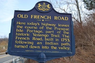
Photographed by Mike Wintermantel, March 20, 2011
1. Old French Road Marker
Erected 1946 by Pennsylvania Historical and Museum Commission.
Topics and series. This historical marker is listed in these topic lists: Indigenous Peoples and Communities • Roads & Vehicles. In addition, it is included in the Pennsylvania Historical and Museum Commission (PHMC) series list. A significant historical year for this entry is 1753.
Location. 42° 5.544′ N, 80° 3.443′ W. Marker is near Erie, Pennsylvania, in Erie County. It is in Millcreek Township. It is on Old French Road (Pennsylvania Route 97) south of Gore Road, on the right when traveling south. Touch for map. Marker is in this post office area: Erie PA 16509, United States of America. Touch for directions.

Regionally, this marker is in Northwestern Pennsylvania. It is also in the American Northeast, in the Mid-Atlantic, in Appalachia, and specifically in Northern Appalachia. Globally, it is in North America, on the Great Lakes, in the Western Hemisphere,
this page online
Other nearby markers. At least 8 other markers are within 2 miles of this marker, measured as the crow flies: Michael Cannavino (approx. 1.2 miles away); Northwest PA Purple Heart Memorial (approx. 1½ miles away); Vietnam Veterans Memorial (approx. 1½ miles away); Flag Display (approx. 1½ miles away); Korean War Memorial (approx. 1½ miles away); Erie County World War II Memorial (approx. 1½ miles away); Colonel Philip Cochran (approx. 1½ miles away); Harry T. Burleigh (approx. 1.6 miles away). Touch for a list and map of all markers in Erie.
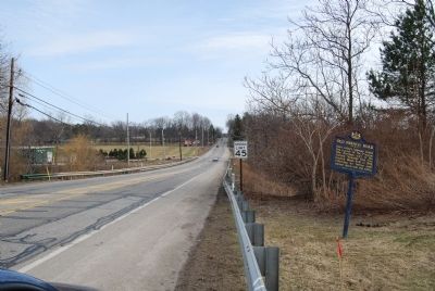
Photographed by Mike Wintermantel, March 20, 2011
2. Old French Road Marker
Looking south on PA 97.
Credits. This page was last revised on February 7, 2023. It was originally submitted on March 21, 2011, by Mike Wintermantel of Pittsburgh, Pennsylvania. This page has been viewed 1,897 times since then and 92 times this year. Photos: 1, 2. submitted on March 21, 2011, by Mike Wintermantel of Pittsburgh, Pennsylvania. • Bernard Fisher was the editor who published this page.
