Radford, Virginia — The American South (Mid-Atlantic)
Starnes
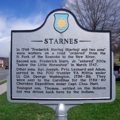
In 1746 “Frederick Stering (Staring) and two sons” were workers on a road “ordered” from the N. Fork of the Roanoke to the New River. Second son, Frederick Starn, Jr., “entered” 200a “below the Little Horseshoe” in March 1747. Other sons, Sgt. Joseph, Pvts. Leonard and Adam, served in the 700 frontier VA Militia under Lt. Col. George Washington, 1756-58. They were sent to the Carolinas for the 1759-60 Cherokee Expedition under Capt. Chas. Hart. Youngest son, Thomas, settled on the Holston but was driven back here by the Indians.
(side b)
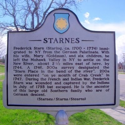
Frederick Starn (Staring, ca. 1700 - 1774) immigrated to NY from the German Palatinate. With his wife, Mary (Goldman), and six children, he left the Mohawk Valley in NY to settle on the New River, about 2½ miles east of here, by 1744. A 1746, 500a survey designated the “Starn Place in the bend of the river”. 200a were entered “on ye mouth of Crab Creek” in 1747. During the French and Indian War, Frederick Starn was wounded and captured by the Indians in July of 1775 but escaped. He is the ancestor of this large old Southern family who are of German descent.
Erected 1992 by Starnes/Starns Triennial Association.
Topics. This historical marker is listed in these topic lists: Native Americans • Settlements & Settlers • War, French and Indian. A significant historical month for this entry is March 1747.
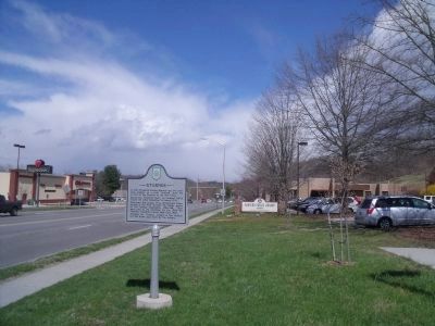
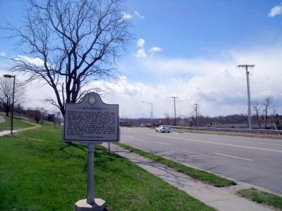
Location. 37° 8.213′ N, 80° 34.201′ W. Marker is in Radford, Virginia. Marker is at the intersection of West Main Street (U.S. 11) and Lee Highway (U.S. 11), on the right when traveling north on West Main Street. Marker is located on the grounds of the Radford Public Library. Touch for map. Marker is at or near this postal address: 30 West Main Street, Radford VA 24141, United States of America. Touch for directions.
Other nearby markers. At least 8 other markers are within walking distance of this marker. High Water Mark (about 700 feet away, measured in a direct line); Native American Village Site (approx. 0.2 miles away); Wildwood Pool (approx. ¼ mile away); Connelly's Run (approx. 0.4 miles away); Montgomery County / Pulaski County (approx. 0.4 miles away); The New River (approx. 0.4 miles away); New River Bridge (approx. 0.6 miles away); The City by the River (approx. 0.6 miles away). Touch for a list and map of all markers in Radford.
Credits. This page was last revised on June 16, 2016. It was originally submitted on April 4, 2011, by Bernard Fisher of Richmond, Virginia. This page has been viewed 1,339 times since then and 65 times this year. Photos: 1, 2, 3, 4. submitted on April 4, 2011, by Bernard Fisher of Richmond, Virginia.


