Bristow in Creek County, Oklahoma — The American South (West South Central)
Bristow Concrete Walk
Photographed by William Fischer, Jr., January 16, 2011
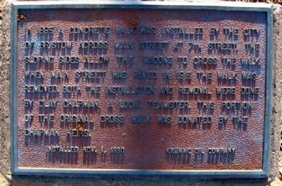
1. Bristow Concrete Walk Marker
In 1895 a concrete walk was installed by the City of Bristow across Main Street at 7th Street. The sloping sides allow the wagons to cross the walk. When Main Street was paved in 1915 the walk was removed. Both the installation and removal were done by Clay Chapman, a local teamster. This portion of the original cross walk was donated by the Chapman heirs.
Installed Nov. 1, 1980
Erected 1980 by Clay Chapman Family and Krumme Oil Company.
Topics. This historical marker is listed in these topic lists: Man-Made Features • Roads & Vehicles • Settlements & Settlers. A significant historical date for this entry is October 1, 1944.
Location. 35° 50.027′ N, 96° 23.538′ W. Marker is in Bristow, Oklahoma, in Creek County. It is on Seventh Street, on the left when traveling west. Marker is on the grounds of the municipal building. Touch for map. Marker is at or near this postal address: 110 West Seventh Street, Bristow OK 74010, United States of America. Touch for directions.

Regionally, this marker is in the Muscogee Nation and in Greater Tulsa. It is also in the American South, specifically on the prairies, and on the Southern
this page online
Other nearby markers. At least 8 other markers are within walking distance of this marker: Roland Hotel (about 300 feet away, measured in a direct line); FRISCO Train Depot (about 800 feet away); Bristow Memories (about 800 feet away); Creek Masonic Lodge (approx. 0.2 miles away); The Julius Rosenwald Fund / Creek County Rosenwald Schools (approx. 0.4 miles away); The Klingensmith Park Amphitheater (approx. half a mile away); 45th Infantry (Thunderbird) Division (approx. 0.8 miles away); Cpl Larry E. Caldwell, US Army (approx. 0.8 miles away). Touch for a list and map of all markers in Bristow.
Another marker is no longer nearby. Bristow Pioneers Plaza (was about 500 feet away but has been permanently removed).
Photographed by William Fischer, Jr., January 16, 2011
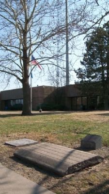
2. Bristow Concrete Walk and Marker
Municipal building in background; looking SE
Photographed by William Fischer, Jr., January 16, 2011
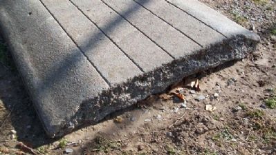
3. Bristow Concrete Walk
Showing curve of walk
Photographed by William Fischer, Jr., January 16, 2011
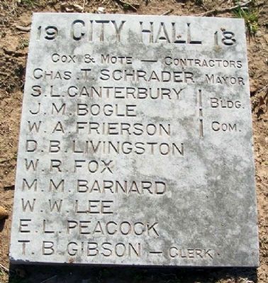
4. Former Bristow City Hall Marker
Located next to the Concrete Sidwalk
Credits. This page was last revised on September 29, 2020. It was originally submitted on April 24, 2011, by William Fischer, Jr. of Reynoldsburg, Ohio. This page has been viewed 747 times since then and 21 times this year. Photos: 1, 2, 3, 4. submitted on April 24, 2011, by William Fischer, Jr. of Reynoldsburg, Ohio.
