Fort Leavenworth in Leavenworth County, Kansas — The American Midwest (Upper Plains)
Fort Leavenworth National Cemetery
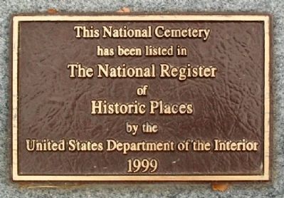
Photographed by William Fischer, Jr., December 22, 2010
1. Fort Leavenworth National Cemetery Marker
has been listed in
The National Register
of
Historic Places
by the
United States Department of the Interior
1999
Erected 1999 by Department of Veterans Affairs.
Topics and series. This historical marker is listed in these topic lists: Cemeteries & Burial Sites • War, US Civil. In addition, it is included in the National Cemeteries series list. A significant historical year for this entry is 1999.
Location. 39° 21.085′ N, 94° 55.773′ W. Marker is in Fort Leavenworth, Kansas, in Leavenworth County. It is on Dixie / Pacemaker near Ironwood, on the right when traveling south. Marker is in ground, adjacent to the cemetery plat map, immediately east of the Lodge. Touch for map. Marker is in this post office area: Fort Leavenworth KS 66027, United States of America. Touch for directions.

Regionally, this marker is in Eastern Kansas and specifically in Greater Kansas City. It is also in the American Midwest, in the Lewis & Clark Corridor, in the Corn Belt, on the prairies, and on the Southern Plains. Globally, it is in North America, the Western Hemisphere, the Western World,
this page online
Other nearby markers. At least 8 other markers are within walking distance of this marker: A different marker also named Fort Leavenworth National Cemetery (here, next to this marker); Henry Leavenworth (within shouting distance of this marker); A National Cemetery System (within shouting distance of this marker); War Memorial (within shouting distance of this marker); Address by President Lincoln (within shouting distance of this marker); Edward Hatch (within shouting distance of this marker); Henry G. Davis (within shouting distance of this marker); a different marker also named Henry G. Davis (within shouting distance of this marker). Touch for a list and map of all markers in Fort Leavenworth.
Also see . . .
1. Fort Leavenworth National Cemetery. (Submitted on April 30, 2011, by William Fischer, Jr. of Reynoldsburg, Ohio.)
2. Fort Leavenworth National Cemetery at Find-A-Grave. (Submitted on April 30, 2011, by William Fischer, Jr. of Reynoldsburg, Ohio.)
3. Fort Leavenworth National Cemetery. (Submitted on April 30, 2011, by William Fischer, Jr. of Reynoldsburg, Ohio.)
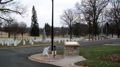
Photographed by William Fischer, Jr., December 22, 2010
2. Fort Leavenworth National Cemetery Marker
Looking south, with Section 2 in background
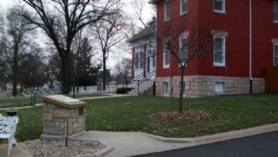
Photographed by William Fischer, Jr., December 22, 2010
3. Fort Leavenworth National Cemetery Marker
Lodge at right background
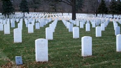
Photographed by William Fischer, Jr., December 22, 2010
4. Fort Leavenworth National Cemetery Section L
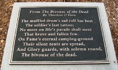
Photographed by William Fischer, Jr., December 22, 2010
5. Fort Leavenworth National Cemetery Rremembrance
Credits. This page was last revised on September 6, 2020. It was originally submitted on April 30, 2011, by William Fischer, Jr. of Reynoldsburg, Ohio. This page has been viewed 1,526 times since then and 27 times this year. Photos: 1, 2, 3, 4, 5. submitted on April 30, 2011, by William Fischer, Jr. of Reynoldsburg, Ohio.
