Bowie in Cochise County, Arizona — The American Mountains (Southwest)
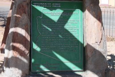
Centennial of Chiricahua Apache/U.S. Cessation of Hostilities
1886
⎯⎯⎯
Chiricahua - Centennial
Photographed by James Nuti, February 25, 2011
1. Centennial of Chiricahua Apache/U.S. Cessation of Hostilities 1886 Marker - Side 1
English Translation
[Side 1: In English :]
September 4-8, 1986, Arizonans marked the return of the Chiricahua Ex-Prisoners of War and their descendants in ceremonies that completed a spiritual circle. We remembered and reflected on the clash between National Expansion and the Chiricahua's determination to resist and remain free on their land, and on how so few could have so great and lasting impact on so many. Together we struggled with notions of equality and cultural differences and achieved a broader perspective on raiding, ware fare, deportation, imprisonment and the repatriation of the Chiricahua People.
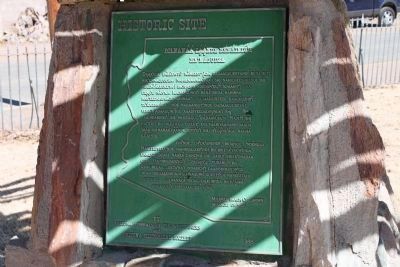
[Side 2 - Apache Translation:]
Editors Note: Click on photo to see text
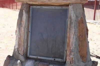
[Side 3 - Artwork panel depicting members of the Apache Tripe]
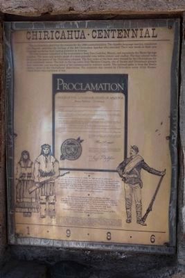
[Side 4 - The Proclamation]
The rock hammer imbedded in the monument is from Tres Castillos,
this page online
Bruce Babbitt – Governor
WHEREAS, the final surrender of Naiche and Geronimo's group and deportation of the entire Chirichua Apache Tribe in 1886 marked the end of this war, the coming of a lasting peace to Arizona, and the beginning of 27 years of imprisonment for the Chirichua, and
WHEREAS, September 4, 1986 will be the 100th anniversary of the Chirichua capitulation;
NOW therefore, I, Bruce Babbitt, Governor of the State of Arizona, and for the citizen of this great State, do hereby welcome the Chirichua ex prisoners of war and all other members of this tribe to Arizona and do hereby proclaim Thursday, the fourth day of September 1986 as the
Centennial of the Chirichua Apache surrender and Imprisonment
AND call upon all persons to observe the significance of these events and to learn of the History and Culture of the Apache people and,
TO participate in centennial events conducted under the auspices of the Arizona Historical Society and the National Park Service In witness whereof, I have hereunto set my hand and caused to be affixed the Great Seal of the State of Arizona
Governor
Attest Rose Mofford
Secretary of State
Photographed by James Nuti, February 25, 2011
2. Side 2 - Apache Translation
We had the first opportunity to retrace the steps and finish the dream of our grandmothers and grandfathers – to return to the land so precious to them that they surrendered and gave twenty-seven years of their lives as prisoners of war for 15,000,000 acres of mountains, streams, and land – you all call desert but to them was life.
Chiricahua-Warm Springs Apache
Erected 1988 by Arizona Corrals of the Westerners and The Arizona Historical Society.
Topics. This historical marker is listed in these topic lists: Indigenous Peoples and Communities • Wars, US Indian. A significant historical month for this entry is September 1863.
Location. 32° 19.552′ N, 109° 29.419′ W. Marker is in
Photographed by James Nuti, February 25, 2011
3. Side 3 - Artwork

Regionally, this marker is in the Sky Islands and in Southeastern Arizona. It is also in the American Borderlands and in the Southwest. Globally, it is in North America, the Western Hemisphere, the Western World, and the Anglosphere. Historically, it finds itself in what was once New Spain and also the Gadsden Purchase.
Other nearby markers. At least 8 other markers are within 13 miles of this marker, measured as the crow flies: Old Fort Bowie (approx. 0.3 miles away); Fort Bowie (approx. 0.3 miles away); Apache Pass - A Corridor Through Time (approx. 11.9 miles away); Mining Cabin (approx. 12 miles away); Apache Pass (approx. 12 miles away);
Photographed by James Nuti, February 25, 2011
4. Side 4 -The Proclamation
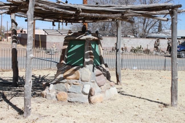
Photographed by James Nuti, February 25, 2011
5. Centennial of Chiricahua Apache/U.S. Cessation of Hostilities 1886 Markers and Monument
Credits. This page was last revised on December 9, 2024. It was originally submitted on April 30, 2011, by James Nuti of Bisbee, Arizona. This page has been viewed 1,779 times since then and 50 times this year. Last updated on May 16, 2011, by James Nuti of Bisbee, Arizona. Photos: 1, 2, 3, 4, 5. submitted on April 30, 2011, by James Nuti of Bisbee, Arizona. • Syd Whittle was the editor who published this page.
