Braithwaite in Plaquemines Parish, Louisiana — The American South (West South Central)
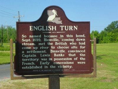
English Turn
Erected 1963 by Department of Commerce and Industry.
Topics. This historical marker is listed in these topic lists: Colonial Era • Exploration • Settlements & Settlers • Waterways & Vessels. A significant historical month for this entry is September 1699.
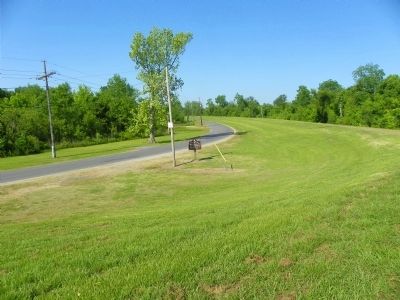
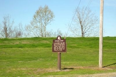
Location. 29° 52.682′ N, 89° 57.849′ W. Marker is in Braithwaite, Louisiana, in Plaquemines Parish. Marker is on English Turn Road (Parish Route 3137) one mile west of Parish Route 39, on the right when traveling west. Touch for map. Marker is in this post office area: Braithwaite LA 70040, United States of America. Touch for directions.
Other nearby markers. At least 8 other markers are within 4 miles of this marker, measured as the crow flies. Fort St. Leon (approx. half a mile away); Bellechasse Plantation (approx. 2.2 miles away); Plaquemines Parish (approx. 3 miles away); a different marker also named English Turn (approx. 3.2 miles away); a different marker also named Plaquemines Parish (approx. 3.2 miles away); Jefferson Parish (approx. 3.7 miles away); Lacoste Plantation (approx. 3.7 miles away); Plantation of Jacques Philippe Villere (approx. 3.8 miles away).
Additional commentary.
1. Marker Vandalized
Google Earth shows the street view in June 2008 and October 2013; both dates show a vandalized and missing marker. (In 2013, the remaining post is further vandalized from its state in 2008). I was wondering if anyone can confirm that its in place currently or at least at a time after these dates?
— Submitted March 6, 2019, by Chris Kourim of Mishawka, Indiana.
Credits. This page was last revised on March 6, 2019. It was originally submitted on May 24, 2011, by Stephen Bell of Biloxi, Mississippi. This page has been viewed 1,485 times since then and 142 times this year. Photos: 1, 2. submitted on May 24, 2011, by Stephen Bell of Biloxi, Mississippi. 3. submitted on January 14, 2014, by Duane Hall of Abilene, Texas. • Bill Pfingsten was the editor who published this page.


